
EURIC, King of the Visigoths. – Born c. 420, died in September 485, he was the founder of Visigothic power in France and Spain. Strong and cunning, he ascended the throne in 466 after violently eliminating his brother Theodoric II. He took advantage of the internal strife and revolutions in which the Roman Empire was dissolving to occupy, in 474, all the territory between the Loire and the Mediterranean, except for Auvergne, which, despite the fierce resistance of its inhabitants, was ceded by Julius Nepos in the peace treaty. From 481 to 484 he succeeded in conquering Arles, Marseille, and all of Provence.
Associating with other barbarian leaders, he occupied a large part of Spain. He easily repulsed an attack by the Burgundians, who had waged war on him out of concern for his growing power, and vigorously pursued pirates who were devastating the coasts. He was the greatest barbarian king of his time, not only for his conquests but also and especially because he drew up, c. 480, the first Visigothic law code. To this end, he relied on the work of Roman jurists, particularly Leo, who was also his prime minister. The fragments that remain of Euric’s code show the same Roman laws, slightly modified by the introduction of Visigothic national traditions. He ruled the subject peoples justly, but although he did not constantly persecute Catholics, he showed distrust toward the clergy and even exiled two bishops.
EUROPE. – One of the five continents of the earth.
OUTLINE:
I. Geography
II. History.I. GEOGRAPHY
It is the smallest of the three parts traditionally recognized in the ancient continent. It forms the extreme western peninsula, ill-defined by physical boundaries from the Asiatic mass on which it is based with a broad foundation from the Arctic to the Mediterranean. With the 10 million sq. km. usually attributed to it, it represents only 6.7% of the emerged lands, 12% of the ancient continent. 65% of its surface belongs to the mainland, 27% to peninsulas, 8% to islands: it follows that it is the most articulated of all parts of the earth, as it is the most deeply penetrated by the sea. However, this character diminishes proceeding from W. to E.: the so-called “timber port-Baltic” of Riga and Odessa allows one to distinguish, from the oceanic-Mediterranean sector, with a very rugged outline, a continental block almost segregated from the direct maritime influence. Europe occupies a central position with respect to most of the emerged lands, and is almost entirely included within the temperate zone (only 7% N. of the Arctic Circle). Its extreme limits fall at 17° and 11' (North Cape), and 34° and 48' (18° island of Gozo) N.; 10° 25' W. (Dunmore Head in Ireland) and 68° 5' E. (Kara Gulf); its territory thus extends 36° 23' in latitude and 78° 30' in longitude.
Contrasting with the modest dimensions of the continent are the complexity of its geological history and the consequent variety in surface forms. In a short space plains and mountains, valleys and hills succeed and alternate, with a generally fragmented plateau, rich in transitions and nuances. Only its eastern night, where it broadens as far as the Urals with a vast lowland, shares in the massive uniformity characteristic of the Asiatic continent. This lowland, almost entirely below 200 m. in height, continues westward into the German and French plains, unbroken even by fresh and vigorous relief, with peaks exceeding 3500-4000 m.: a whole series of “chains” traverses it, from the Strait of Gibraltar to the Aegean and the Black Sea (Sierra Nevada, Pyrenees, Alps, Apennines, Carpathians, Balkans), enclosing between the folded and arched complexes, where fragments of older uplifted masses (Spanish Meseta), where depressions once invaded by the sea or occupied by lakes, and later filled in whole or in part. The highest elevations in Europe are found in this zone (Mont Blanc, 4180 m. in the Alps, Mulhacén, 3481 m. in the Spanish Sierra Nevada); in the other two, the highest values remain notably lower (Glittertind: 2478 m. in Norway; Puy de Dôme: 1886 m. in Auvergne).
When one excludes the narrow peristatic fringe and the high mountain regions, all of Europe lies within the domain of temperate climates. The countries around the Mediterranean are characterized by mild and short winters, hot and long summers, rainfall mainly in winter, summer drought, and great atmospheric luminosity. In the remaining sectors one passes gradually from the typically oceanic climate of western Europe, with cool summers, mild winters, slight temperature ranges, abundant and evenly distributed rainfall, to the markedly continental climate of the Sarmatic lowland, where winters become harsh and long, summers short, diurnal and annual temperature contrasts high, and precipitation decreases, falling mainly in summer. The extreme conditions here too foreshadow the behavior of the neighboring Asiatic sectors (Siberia), to which the circum-Pacific depression likewise recalls central Asia, where temperature ranges remain very high and rainfall, almost all in spring, is reduced to minimal values.
Natural vegetation originally reflected well, in its landscape aspect, the complicated range of these variations: long human occupation, however, has notably altered the terrain almost everywhere through deforestation and cultivation, obscuring primitive conditions. Apart from the slender fringe of tundra that fringes the circumpolar area, European territory for the most part falls within the domain of the forest (of conifers in the northern region, mixed and broadleaf in central Europe), while toward the SE. stretch treeless zones that merge into true steppes in the circum-Caspian sector. The countries bordering the Mediterranean, instead, are covered by the so-called maquis, formed by low evergreen thickets and small trees: especially characteristic is the spread of the olive and the oak.
Europe’s absolute population today is about 540 million: less than half that of Asia and a little more than one-third (22.7% in 1948) of the earth’s total. In the last two centuries it has almost quadrupled: it was 100 million in the mid-17th century, 173 at the beginning of the 19th, over 400 at the beginning of the following century and almost identical to the present figure before the two world wars, in 1914 and 1940. The density figure (53 per sq. km.) is by far the highest among the parts of the world (about 6 times that of Asia, more than 9 times that of Africa and South America); but this average value results from extremes (282 per sq. km. in Belgium, 250 in the Netherlands, 207 in the United Kingdom) and minima (10 in Norway, 13 in Finland, 15 in Sweden) that are very far apart. Both density and agglomeration in urban centers tend to decrease, roughly, from W. to E., being highest in regions where large-scale industry flourishes. Europe has 16 of the 41 cities with over 1 million, and 30 of the 72 with over 500,000 inhabitants that exist in the whole world (c. 1948).
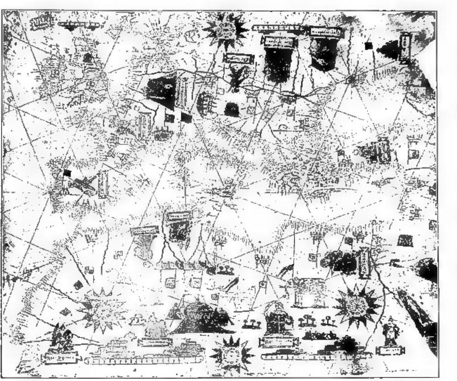
Europe – Portolan chart for the Mediterranean ports. Pen and watercolor, 16th century.
The current (1950) political situation is summarized in the table below.
Although this situation must still be considered fluid in some cases (Germany, Trieste), the table immediately reveals the profound political changes brought about by the Second World War: only 13 of the 31 European states (excluding Turkey and the Free Territory of Trieste, which is destined to disappear) do not show territorial variations. Equally notable are the voluntary or forced population movements (especially of Germans and Poles) that preceded, accompanied, and followed the war; as well as the territorial and demographic enlargement of the U.S.S.R., which now includes within its borders more than 7% of the surface area and over a quarter of the population of Europe. As for the distribution of this population among the three main ethnic-linguistic groups—Neo-Latin, Germanic, and Slavic—the numerical balance recorded a century ago (one-third of the population for each) has now been broken to the advantage of the Slavs, who alone, with about half of the total, face the other two groups combined.
That a profound upheaval has occurred in the European economy over the last thirty years, especially as a result of the two world wars, is evident, but it may be premature to attempt to define this upheaval in statistical terms, not least because, aside from the difficulty of accounting for the new political arrangements, data regarding the European sector of the U.S.S.R. are lacking. Nevertheless, the need to refer to pre-war conditions is justified by the rapid recovery now underway in all sectors of this economy, even if its value has been decisively diminished in the new configuration of international relations.
Approximately half of Europe’s soil is cultivated (a maximum of 7% in lowland countries); less than one-third is covered by forests (northern and eastern regions) and scrubland (Mediterranean countries); roughly one-tenth is devoted to natural meadows and pastures (in the north); the remainder is unproductive (a maximum of 7% in the northeastern zones). Before the Second World War, Europe accounted for 90–95% of the world’s cork production, 18–25% of olive oil, over 18% of oats, flax, and sugar beets; 75% of flax, 60% of wheat and barley, etc., while for other crops (maize, rice, tobacco, cotton) the quantities were modest. Even today, most of these continental primacies are maintained or are in the process of being regained, but increased consumption has necessitated a greater volume of imports, as Europe, even before the war, was clearly deficient overall in vegetable raw materials, especially in the sector destined for industry (textiles and oilseed crops).
Pre-war Europe raised 25% of the world’s cattle (U.S.S.R., Germany, France), 33% of sheep (U.S.S.R., Ireland, Mediterranean Europe), 40% of pigs (U.S.S.R., Germany, Poland, France), and 40% of horses (U.S.S.R., Poland, Germany). The livestock population was devastated by the war, but it has now been almost entirely reconstituted or is in the process of being reconstituted (with the exception of pigs). Today, there are probably about 150 million head of cattle, 140 million sheep, 50 million pigs, 25–30 million goats, and 20 million horses. As for fishing, the Atlantic countries of Europe alone produce almost one-third of the world’s total catch.
Although Europe is poor in genuine deposits of precious metals, it has played a significant role in external economic activities, as its geologically older terrains conceal substantial reserves of other minerals.
About three-fifths of these exchanges have now probably declined to just one-third, with the additional fact that nearly all the states of the continent show a passive trade balance.
European trade is predominantly maritime: in the pre-war period, two-thirds of the world’s merchant fleet belonged to Europe. The heavy losses caused by the war have reduced its capacity to less than half and have also altered the hierarchy of its ports, three of which (London, Rotterdam, Antwerp) normally handled over 20 million net tons of cargo annually in and out. Only northern Europe (the Danube, Rhine) is fully exploited by international traffic. In the European part of the U.S.S.R. alone, there are 38,000 square kilometers of navigable inland waterways, which essentially serve internal traffic. The most important network of communications in Europe is the railway system, whose density is greatest in central and western countries (12 km per 100 sq km). Altogether, the continent now has 420,000 km of railways (31.5% of the world total); the post-war period has seen an expansion of these communications especially in eastern Europe (Poland, Ukraine, central Russia). Also in the post-war period, air traffic has developed greatly, now ensuring regular and rapid connections not only between all the countries of the continent but also between Europe and other parts of the world (10–12 hours of transoceanic flight between Europe and North America; noteworthy in this regard is the growing importance of the Mediterranean).
II. HISTORY
### I. IN CLASSICAL GREEK AND ROMAN TIMES
Europe is a geographical complex with a distinctive physical configuration, marked by its relief, watercourses, and climate. But Europe is also a historical complex, with a distinctive moral configuration, characterized by its own traditions, memories, customs, tastes, art, religious life, thought, and culture. The concept of these two Europes—one physical, the other spiritual—developed and matured slowly over time, both