
POLAR LANDS. - GEOGRAPHY - This designation refers to the whole of the continental or insular territories extending through the regions near the Poles. While in the boreal cap, forming a vast maritime basin (Arctic Ocean: 14.2 million sq. km.), they consist entirely of islands, the largest of these being Greenland, which with Cape Morris Jesup reaches as far as 83° 40' N. (the northernmost point of the peri-Arctic landmasses), the South Pole is occupied by a vast continent (13.2 million sq. km.) which, in the opposite direction, extends beyond the polar circle, reaching 63° 30' S. in Graham Land; by contrast, the islands are few and far apart, scattered across an expanse of water that is even more extensive (Antarctic Ocean: 20.4 million sq. km.).
Of the Arctic islands (246,500 sq. km.), the largest (163,500 sq. km.) belong to the European sector, among them Spitzbergen, Novaya Zemlya, and Nansen Land; the first are Norwegian possessions (they form the prefecture of Svalbard), notable for their economic value (fishing, and above all coal mining) and because
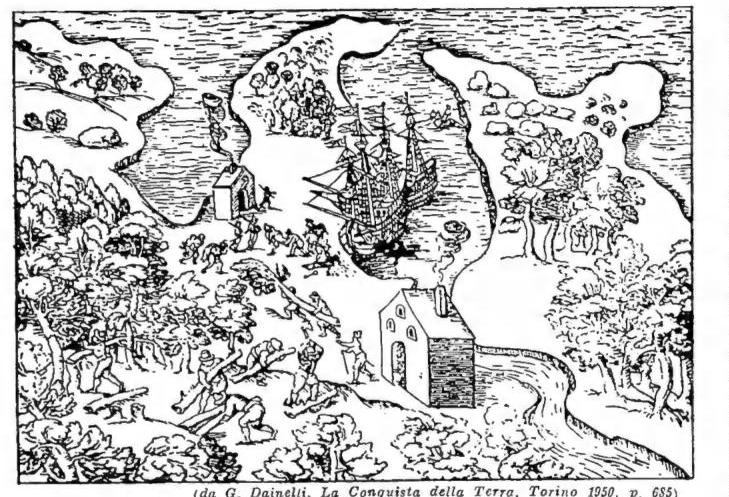
POLAR REGIONS – Preparations for the Danish Arctic expedition (1605–20). Engraving taken from the Navigatio Septentrionalis, Copenhagen 1624.
permanently inhabited (1,000–1,500 souls); the latter belonging to the USSR. To the USSR also belong all the islands of the Asian sector (Severnaja Zemlja, New Siberia, Wrangel, etc.; 8,000 sq. km. in all), for the most part uninhabited, but recently acquiring special importance because of their position along the Northeast Passage, on which the Soviet Union has sought to organize regular commercial traffic. In the American sector, the Arctic territories include all of Greenland (2.2 million sq. km.) and the Canadian archipelagos (13 million sq. km.), still of little economic value, but likewise the object of increasingly thorough studies and investigations because of their presumed or confirmed mineral resources and their strategic importance.
Antarctica consists, apparently, of a vast plateau, at an average elevation of more than 2,000 m., still almost entirely unknown, which seems to be bordered toward the W. (Ross Sea) by a series of mountain ranges, rising in places to more than 4,000 m. (6,100 m. in the American sector), and believed to link the South American archipelago (Graham Land) with New Zealand. The entire region is covered by a thick mantle of ice; immense glaciers descend from the plateau toward its margins and, merging, form a continuous ice sheet, which terminates in the long (600 km.) wall overhanging the sea. Some of this ice extends into the latter, forming the so-called ice shelves: the largest, the Ross Ice Shelf, extends over half a million sq. km. The polar pack ice, finally, is here much more extensive than in the Arctic and reaches as far as between 60° and 50° S. The climate is extremely severe, certainly the coldest on the globe. Given the average annual temperatures (−25°) and absolute minima (−80°), the frequency and violence of hurricanes and winds, and the fact that the limit of permanent snow is here (and only here) at sea level, it may be said that Antarctica is always subject to winter conditions—and to a terrible winter. Vegetation and fauna are almost entirely absent inland; in the narrow coastal strip, where the ground is free of snow, only mosses and lichens grow, while seals, leopards and elephant seals, penguins, petrels and gulls live there. Nevertheless, although permanent human settlements are impossible everywhere, the importance acquired in the surrounding seas by the hunting of marine mammals (whales, fin whales, sperm whales), the desirability of exploiting the continent’s strategic and commercial position (air bases), and the hope of making use of its presumed or confirmed mineral resources (coal, radioactive rocks?) have long led to a political partition of Antarctica into sectors (therefore delimited by meridians), which follow one another in
this order (longitude from Greenwich): 1) Norwegian (20° W–45° E; from Coats Land to Queen Maud Land, together with Bouvet and Peter I Islands; 2.5 million sq. km.); 2) Australian (45°–136° and 142°–160° E, south of 60°; also called East Antarctica, or the Wilkes–Enderby complex; 4.5 million sq. km.); 3) French, or Adélie Land: 136°–142° E, with the Kerguelen Islands, the Crozet Archipelago, the McDonald, Heard, St. Paul and New Amsterdam Islands (370,000 sq. km., administratively dependent on the governor of Madagascar); 4) New Zealand, or Ross Dependency: 160° E–150° W, likewise south of 60°; including, among other areas, the whole of the Ross Sea (2 million sq. km.); 5) United States: 150°–80° W, in the so-called Pacific Quadrant (1.8 million sq. km.); 6) British: 80°–20° W, south of 58°, between 80° and 50°; elsewhere south of 50°, also including Graham Land, the Shetland, Orkney, South Sandwich and South Georgia Islands (8.5 million sq. km., administratively dependent on the Falkland Islands; while the islands of Tristan da Cunha, Gough and the nearby islets are attached to the island of St. Helena).
[This partition has nevertheless given rise to numerous disputes; in fact, other claimants have joined the original ones—not excluding Germany, which claims part of the Norwegian sector—among whom Argentina and Chile appear to be the most directly interested, if only because of their geographical position, in establishing a foothold in the British sector. Argentina has already established a naval base in the Bay of Scotland (South Orkney Island) and two meteorological stations on Melchior Island (off the western coast of Graham Land) and at Port Foster, on Deception Island, while Chile, for its part, had, as early as February 1948, established its own settlement (Soberania) on Greenwich Island, likewise in the Graham Land sector. Argentina claims the territory between 25° and 74° W, south of 60°; Chile claims that between 53° and 90° W.
As for the two Poles, it should be recalled that the North Pole coincides with a point in the Arctic Ocean at a depth of 2,743 m.; the South Pole, with a point on the plateau at an elevation of 2,765 m.
The exploration of the Arctic lands dates back to the Middle Ages, when the Normans discovered and colonized Iceland and Greenland; before that, there had been only legends about the “Hyperborean Sea” and “Ultima Thule,” the solitary island constantly illuminated by the sun. In the sixteenth century, the numerous attempts to find a Northeast and a Northwest Passage—from Europe and North America, respectively, toward eastern Asia—led inadvertently to at least a rough knowledge of many Arctic lands (Novaya Zemlya, Svalbard, the Bear Islands, and part of the American Arctic Archipelago): Barents, Frobisher, Davis, Hudson, Baffin, and others contributed to this. After two centuries of stagnation, exploration resumed in 1818 with Ross and Parry (the latter also responsible for the first attempt to reach the Pole), and it was not always successful (one need only recall the mysterious fate of Franklin). In 1850 Collison and McClure discovered the Northwest Passage; in the following years the American Arctic world was explored almost entirely by the English and Americans.
The Northeast Passage was completed for the first time by Nordenskiöld and the Italian Bove in 1878. Other fruitful expeditions were those of Nansen (1893–96), the Duke of the Abruzzi (1899), Sverdrup (1898–1902), Amundsen (1903–1906), and the Canadian Arctic Expedition (1903–10). It was only at the beginning of the twentieth century, however, that the nonexistence of an extensive continental or insular landmass around the Pole was demonstrated. The exploration of Greenland, in particular, is due chiefly to Jensen, Nansen, De Quervain, Nordenskiöld, Rasmussen, Peary, Kock, and Wegener, the last of whom lost his life there in 1931. The principal expeditions toward the North Pole, which had been attempted to be reached as early as 1773, were, besides those of Nansen and the Duke of the Abruzzi already mentioned, those of Peary—who has the distinction of having been the first to reach it by land, on 6 April 1909—of Byrd (by air, in 1926), Amundsen-Nobile (1926), Wilkins (1927), Nobile (1928), and the airship Conte Zeppelin (1931). As for the undertaking of General U. Nobile, it should be recalled that, through Cardinal Tosi, Archbishop of Milan, he received from Pius XI a cross bearing an inscription composed by the Pontiff himself, so that it might be cast upon the North Pole. This took place on 24 May 1928. The advances achieved by aviation subsequently led to the almost complete conquest of the Arctic lands. Over the last ten years, American, Russian, and English aircraft have flown extensively over much of the land and sea areas north of the Arctic Circle. Particularly important were the modernly equipped military expeditions, both terrestrial (including the American expedition of 1946, known as Musk Ox, and the Danish expedition of 1947 in Peary Land, the northernmost region in the world) and maritime (among which the expedition of the United States aircraft carrier Midway in Baffin Bay should be recalled).
The history of Antarctic exploration is brief and recent. The first voyages, from that of Tasman to that of Cook, gradually dispelled the hypothesis of a southern land, which the cartography of the sixteenth century, following Hipparchus, Marinus, and Ptolemy, had accepted, in fact lowering the equatorial limit of that continent to latitudes close to 50°. G. Cook inaugurated modern exploration: in his three voyages undertaken between 1772 and 1773, he demonstrated the nonexistence of the continent at low latitudes and the isolation of New Zealand, the Kerguelen Islands, Bouvet Island, and South Georgia. The second circumnavigation of the Antarctic ice cap, after Cook’s, was carried out by Ballinghausen (1819), and the third by Biscoe (1830), who made the first discovery of Antarctic continental mainland, namely Enderby Land. The investigations conducted by whalers were followed, from 1838 onward, by initiatives undertaken by governments and scientific societies: the voyages of D’Urville, Wilkes, and above all James Ross are noteworthy. Ross explored the sea that later took his name, discovering Victoria Land and the two volcanoes Erebus and Terror. Toward the end of the last century, the expeditions of the Belgica and the Red Cross initiated a new phase
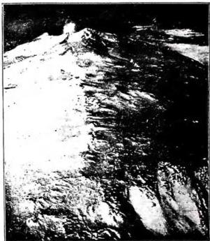
The Antarctic is nevertheless, broadly speaking, still an unknown land (the last one); in fact, only its general features are known, and even these only vaguely (it has not yet been established, for example, whether or not a channel connects the Ross Sea with the Weddell Sea). The best-known areas at present are Graham Land and the Ross Sea.