
GEOGRAPHY. - It is, in general, the science that studies the various parts of the Earth's surface.
CONTENTS:
I. Definition, concept, and methods
II. The Earth's surface
III. Geographical maps
IV. Geography in its historical development
V. Geography and its subdivisions
VI. Scientific geography and as a coordinating science
VII. Geography, related and auxiliary sciences.I. DEFINITION, CONCEPT, AND METHODS
The etymology of the words γῆ (gē, earth) and γράφειν (graphein, to describe), according to which the Greeks would have designated this science as the description of the Earth's surface, does not perfectly correspond to the current scientific concept of geography, which instead seeks the causes and effects of phenomena on the Earth's surface. While, as a scientific discipline, geography was established only at the end of the 19th century, considered as the science of the Earth, it represents one of the oldest branches of knowledge, dating back to the work of Ionian philosophers in the 7th and 6th centuries B.C., when it was theoretically concerned with determining the shape and dimensions of the Earth, and to the 1st and 2nd centuries A.D., when, for practical purposes, it aimed to illustrate the various parts of the Earth and to establish a descriptive design (Polibio, 2nd century B.C.; Strabone, 1st century A.D.; Claudio Tolomeo, 2nd century A.D.).Geography, which by its methods and aims has distinguished itself among other disciplines related to the Earth and has had to restrict its field to a unique and synthetic system, and which has repeatedly changed the boundaries of its domain, can be defined as the science that studies the regional distribution and spatial coordination of physical and anthropic facts manifesting on the Earth's surface and in marine spaces, considered in their causes, effects, and relationships of interdependence and connection, and outlining in particular typical aspects of the landscape.
It is called a unique and synthetic system because, through the method proper to geography, the results of those other disciplines are coordinated which, though not having a geographic character, are considered useful for their points of contact, their relations, and their common fields of research.
The task of geography is not so much to systematically coordinate facts and phenomena that manifest on the Earth's surface, but rather to localize these manifestations in relation to their extension—that is, the space they occupy—and to their correlation with all the constituent elements of the landscape and the environment. The landscape and environment, objectively described, result from the combination of natural and artificial elements, from the terrain as nature presents it for a given period of time and in a certain space, and with all the transformations wrought by man.
Given the ever-changing aspect of the Earth's surface, geography, as the scientific description of this, refers to the current geological period and thus takes into account only the variations that the Earth's crust may have undergone in historical times.
Geographical investigation can essentially be carried out by employing various research methods: the principle of extension, that is, the study of the area in which a phenomenon extends over the Earth's surface; the principle of coordination, according to which "the geographical study of a phenomenon presupposes the constant concern for analogous phenomena that may manifest in other points of the globe" (E. De Martonne) and consequently creates for geography the tendency to scientifically classify the facts it studies; the principle of causality, the search for the causes that determined the extension and distribution of a phenomenon on the Earth's surface, for which the historical consideration of facts constitutes a truly original character of modern geographical science; the principle of correlation, according to which the various parts of the Earth's surface must be considered in continuous and constant relations with each other, as if belonging to a single organic body.
Geography is thus a synthetic science because the results acquired by other disciplines, which do not have a geographical character, are coordinated by it through methods that, by the principles described above, ensure this science a distinct individuality compared to others.
II. THE EARTH'S SURFACE
Through direct observation, only a very limited thickness of the Earth's crust—or rather, the rocky envelope forming the solid outer part of the planet—is accessible. The meaning of "Earth's surface" should therefore not be understood in a literal or geometric sense, but rather as the existing thickness accessible to human experience and daring, as well as to organic life. The difference between the highest altitudes and the greatest depths is negligible compared to the mean radius of the geoid (6,371 km). Nevertheless, this solid, superficial layer—within whose basins lie the oceanic waters—constitutes the field of geographical investigation, making both vertical and horizontal forms a fundamental element of our study. Both are subject to variability, which generally goes unnoticed because, during a historical epoch—a minuscule fraction of a geological era—no essential changes occur, or at least these escape the notice of "briefly living" humanity. While the study of transformation processes interests the geologist for interpreting past phenomena and the history of the Earth's evolution, it also concerns the geographer, for it is precisely from endogenous and exogenous actions and energies that the current forms of the Earth's surface result. However, the mere external description of these forms is unsatisfactory unless complemented by an investigation into the physical processes through which it becomes evident that the Earth's surface is in perpetual becoming.
Regarding the horizontal distribution of the Earth's crust, continental masses are generally distinguished from oceanic basins. The former constitute the most stable zones of the Earth, having been subjected over long geological periods only to general and uniform uplift movements. The latter are areas covered by water, with a relief far simpler than that of subaerial regions, and are perhaps considered as such due to the incompleteness of our knowledge of marine bathymetry. The emerged lowlands, as well as those lying between the edges of continental masses and oceanic basins, form the continental shelves, while geosynclines are zones of the Earth's crust characterized by particular vertical and horizontal mobility, altering the original position of deposits and raising them to considerable altitudes through the great foldings of the lithosphere. These zones are marked by unstable equilibrium, strong gravity anomalies, and high seismicity. Continental masses are believed to consist of rocks that, on the whole, are lighter than those forming oceanic basins, which are, however, more plastic than the former. Based on gravity measurements, geophysics posits that the Earth's crust floats in a state of equilibrium upon a very dense fluid substratum. This isostatic equilibrium (Sial in secular hydrostatic equilibrium upon Sima) follows Archimedes' principle, whereby the weight of the immersed body equals the weight of the displaced fluid. Hence, A. Wegener's (1880–1930) theory of continental drift: continental masses, once united in a single block (Pangaea) and surrounded by a single ocean (Panthalassa), would have undergone fractures and subsequent divisions into multiple parts during the Jurassic period, gradually drifting from their original position. Beyond the geological and paleontological arguments supporting this theory, the striking concordance of opposing continents—particularly the parallelism of the Atlantic shores—remains noteworthy. Geographical homologies, that is, similarities of form, were already noted by Francesco Bacone (d. 1626) in the Novum Organum, where he refers to the "similitudines physicae in configuratione mundi", later by R. Forster, who observed how continents taper and end in points toward the south, and subsequently by L. Agassiz, O. Peschel, A. Penck, and Olinto Marinelli.
The emerged lands can be estimated at 140 million km², while the seas occupy 361 million km², for a total of approximately 510 million km², corresponding to the Earth's entire surface, according to geodetic calculations. An important geographical fact is the lack of any regular arrangement in the current distribution of lands and waters; thus, lands and seas are unevenly distributed (a kind of opposition is noted between continents and oceans, the former grouped in the Northern Hemisphere, the latter in the Southern), along with the singular antipodal disposition whereby the antipode of a continent is typically an oceanic basin, and vice versa.
III. GEOGRAPHICAL MAPS
Geography is an observational science, yet its object is such that it cannot be studied either directly or by resorting to a means that reproduces what is peculiarly its object of study. Fully autonomous in its scientific and technical organization, cartography aims to represent all or part of the Earth's surface on a plane, creating not only ideal graphic expressions but true metric expressions from which to derive most measurements of the territory being represented. As a symbolic expression of phenomena as localized and distributed on the Earth's surface, it avails itself of the assistance that geodesy, topography, mathematics, statistics, and other sciences can provide.According to G. Caraci, a geographical map is "the representation on a plane of all or part of the Earth's surface, a representation obtained by means of points, lines, and symbols that are interconnected, and all together, in relation to the represented area, by relationships of position, direction, and distance determining as exactly as possible."
Maps, both a tool and a source not only of research but also of description, are indispensable for any geographical study, and without them it would not be possible to organize the acquired facts. Plane, reduced, and approximate images of the Earth's surface, their construction involves solving a geometric problem that seeks to reproduce, with minimal deformation, geometric constructions devised by mathematicians through various procedures called geographical projections. The grid of coordinates, the foundation of the design, assigns to each point on the Earth's surface a corresponding point on the map. Due to the alterations that reality introduces, the projection will thus be conformal (isogonic or orthomorphic) if meridians and parallels intersect perpendicularly as on the sphere, preserving equal angles, maintaining a "form" identical to that on the sphere, but presenting the drawback of not being able to maintain the same scale in every part of the map. The projection will be equivalent when the areas on the map are proportional to the corresponding actual area, though the individual figures represented undergo considerable deformations, particularly toward the peripheral part of the map. It will be an equidistant projection if, along certain lines, the map preserves lengths proportional to real distances. Since it is impossible to construct maps that combine all three aforementioned conditions, means have been studied to create, through projections, conventional systems in which the approximate coexistence of two of these conditions is possible. Thus, projections are distinguished between those made directly on the plane and those obtained by means of an auxiliary surface (cylinder, cone); the former are azimuthal (horizontal) projections, the latter are development projections (conic and cylindrical).
The choice of projection depends not only on the content and purpose of the map but also, and primarily, on the extent of the region to be represented and its position relative to geographical coordinates. Depending on the scale of proportion—that is, the ratio between graphic lengths and natural lengths—maps are topographic, chorographic, and geographic. Depending on the nature of the phenomena they represent, maps are physical, orographic, hydrographic, political, ethnographic, demographic, economic, zoo- and phytogeographic, geological, etc.
Of particular importance are maps that illustrate the global distribution of followers of various religions, as well as atlases constructed for this purpose.
An important problem in cartographic technique is the design and use of graphic symbols and those colors most appropriate for effectively and clearly representing the reality of the Earth's surface: hatching, shading, contour lines (isohypses) do not exist on the terrain, and the difficulties in finding conventional signs that, in the smallest space, can immediately convey the idea of a phenomenon are well known.
The chromoplastic process, moreover, is linked to the established custom of providing an overall image of the terrain with specific surface tints: blue for the sea, lakes, and rivers; green for lowlands; and brown for reliefs.
Representability varies depending on whether the objects or phenomena are isolated or spread over a surface, whether the representations are quantitative or qualitative, variable over time, or describe phenomena in motion, etc. The methods of representation change depending on whether the objects are point-like, linear, or extended over a surface. In the quantitative representation of facts with surface extension, reference is often made to isometric or isarithmic curves—lines passing through points on the Earth's surface where the intensity of a given phenomenon is the same. When these are not applicable, other widely used methods include mosaic cartograms (each division receives a color or hatching corresponding to the average intensity of the phenomenon in that region) and the dot system (with a number of dots proportional to the absolute magnitude of the phenomenon to be represented). All maps are evidently approximate; the main causes of their imperfection are due to deformations arising in the projection from inaccuracies in graphic representation, deficiencies in surveying, and insufficient data. For surveys in vast and inaccessible areas, aerophotogrammetry has seen increasing development in recent years. Though thus serving as a synthetic representation of a large number of factual data, the map cannot be considered the final result of scientific research.
IV. THE DEVELOPMENT OF GEOGRAPHY THROUGH HISTORY
I. In ancient times. - The very etymology of the word demonstrates that this science originated among the Greeks, where it initially signified the representation of the earth through a map. Later, it was used to indicate a description not only on a map but also in words of the entire world then known, while the description of a limited region was called chorography, a term still in use today.Traces of primitive stages of knowledge appear in the Iliad and the Odyssey (2nd millennium B.C.), while the merits of the first explorations of the Mediterranean basin belong to the Cretans (15th century B.C.) and their heirs: the Mycenaeans and the Phoenicians. The Greek expansion into the Mediterranean countries (7th-6th centuries B.C.) subsequently broadened the known horizon with results that, for that time, can be considered grand.
It was Anaximander of Mileto, a disciple of Thales, who sketched the first map of the world and coordinated views about the earth. He created the image of the ecumene (inhabited earth) as an island surrounded on all sides by the Ocean, from which it had emerged due to the reduction of water following the absorption of solar rays. At the end of the 6th century, Anaximander’s map was perfected by Hecataeus, who accompanied the work with a commentary describing a territory vaster than those previously studied, thanks to the knowledge acquired in the meantime of other regions: the Scythians and Ethiopians, Celts and Indians were indeed the peoples placed by Hecataeus at the extreme limits of the ecumene. While Anaximander considered the fundamental object of geography to be the execution of maps, Hecataeus began to regard geography with both scientific and practical intent, as a description of countries and peoples. Herodotus (485-430 B.C.) was more a chorographer than a geographer, a more precise describer of particular countries than an elaborator of general syntheses, while Aristotle (second half of the 4th century) was dominated by excessively general and speculative tendencies, often at odds with the true reality of observed facts. Nevertheless, he pointed out new luminous paths in the astronomical and cosmological field, based on the sphericity of the earth.
The conception of the earth as a flat disk (of Anaximander, Hecataeus, and their successors) fell in the course of the 5th century with the school of Pythagoras, which arrived at the idea of sphericity. Parmenides (513-440 B.C.) laid the first foundations of climatology, and the mathematician Eudoxus (or Eudoxus) attempted to measure the dimensions of the terrestrial globe.
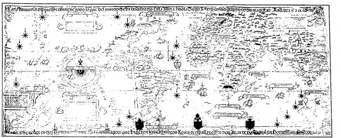
GEOGRAPHY - Nautical chart of 1529 by Diego Ribero. Vatican Library.
(photo: Vatican Library)
of the terrestrial globe. The era of Eratosthenes marks the peak of ancient geographical science, which, with Aristarchus of Samos—a precursor of Copernicus in constructing the heliocentric system—also reached highly audacious conceptions regarding the solar system. The Eratosthenian work was later continued by Posidonius of Apamea (ca. 140-65), who wrote learnedly on the Ocean and its phenomena and dedicated himself to physical geography, meteorology, and may furthermore be considered the precursor of the most modern of geographical sciences: anthropogeography. However, he did not attempt, as Eratosthenes had, a general work of synthesis of geographical knowledge. Among the opponents of Eratosthenes were one of the greatest Greek astronomers, Hipparchus of Nicaea (ca. 190-125), and the Stoic Crates of Mallus.
While the Greek spirit was more inclined toward pure scientific inquiry, the Roman spirit had more practical aims. Roman conquests between the second half of the 2nd century B.C. and the first centuries A.D. provided secure knowledge of Gaul, Germania, part of Iberia, Britannia, etc. Africa and Asia were traversed by Roman legionaries, and the extension of the ecumene through their efforts thus expanded. In the age of Augustus and immediately thereafter, new conceptions of geographical synthesis were elaborated. By Augustus' will, the administrative reorganization of the Empire was established (comprising itinerary works, cadastral records, official descriptions of the provinces, etc.), which favored the elaboration of geographical works. Meanwhile, Agrippa, a great collaborator of Augustus, had a map of the entire known world, and of the Roman Empire in particular, engraved in a portico in Rome. Strabo, Pomponius Mela, and Pliny the Elder wrote in the following years powerful geographical works and set as the supreme aim of geographical science the relations between the natural characteristics of each country and the ethnic, social, and cultural conditions of individual peoples. From a descriptive standpoint, and as a general synthesis of the knowledge acquired by the end of the Augustan age, Strabo’s geography is truly comprehensive, even if its approach is more limited, descriptive, and practical than the Greek Eratosthenian one.
At the beginning of the 2nd century A.D., one finds Marinus of Tyre, whose main work—a new map of the world—is known only through Ptolemy. Ptolemy, however, was primarily an astronomer, who consolidated the geocentric cosmic system and disseminated the value of the measurement of the Earth’s circumference (180,000 stadia), already accepted by Posidonius, a measurement corresponding to a terrestrial globe much smaller than reality.
In summary, it can be said that, while Greek geography expressed itself especially in graphic form (maps), in the Roman age the expository form prevailed. At the foundation of both approaches, however, one can place the elaboration of observational and experiential data.
2. In the Middle Ages and the Renaissance
Geographical science underwent a broad interruption in the Middle Ages because, with the breaking of the unity of the Roman State, relations between peoples were much more limited, and new knowledge had no way of spreading. Culture, almost entirely in the hands of the Church, was also imprinted in the geographical field with a symbolism at times far from reality: the circular mappae mundi, for example, often had Jerusalem as their center. Descriptions in this period are arid, often reduced to mere lists of countries, peoples, and cities. St. Isidore of Seville (336), St. Bede the Venerable (733?), and Rabanus Maurus (9th century) wrote geographical works of no excessive value. Conversely, among the Arabs flourished a rich geographical literature, predominantly descriptive, which however remained almost entirely unknown to Westerners, who knew only Ptolemy’s astronomical work. The Scholastic period was based precisely on the physical principles of Aristotle and the cosmic system of Ptolemy when studies on the terrestrial globe were resumed. Gervase of Tilbury (early 13th century), Alexander Neckam (1157-1217), Albertus Magnus (1206-80), Vincent of Beauvais (ca. mid-13th century), Roger Bacon (1214-94), and Ristoro of Arezzo all based themselves without distinction on Aristotelian-Ptolemaic doctrines, harmonizing with the principles of Christian theology. Observation in the geographical field still did not exist, and the new knowledge brought to geographical science by Giovanni da Pian del Carpine, Rubruck, Odoric of Pordenone, and Marco Polo was met with disbelief.A renewal can be found at the beginning of the 14th century in the cartographic field: nautical charts, regional maps, new circular mappae mundi appear, while descriptive geography remains unchanged until the 15th century. In this period, Aeneas Silvius Piccolomini, who later became Pope Pius II (1458), compiled a geographical work (Historia rerum ubique gestarum locorumque descriptio), one of many examples in which the then-current use of the name cosmography is encountered. Between the mid-15th and mid-16th centuries, Bartolomeu Dias, Vasco da Gama, Christopher Columbus, and Ferdinand Magellan brought with their enterprises a revolution in the world of geography: the sphericity of the Earth was universally recognized, the globe appeared enormously vaster than could be suspected, the extent of oceanic areas was revealed as unimagined. The study of and interest in nature were rekindled, and in Humanism the long-forgotten works of Strabo and Ptolemy were brought back to light; cartography returned to prominence, and names such as Leonardo da Vinci, Fineo, Gastaldi, Apian, and Mercator gave life during the 16th century to a great number of systems for representing the entire globe.
The resurrection of descriptive geography occurred with Sebastian Münster (1544). By the end of the 16th century, the Aristotelian system crumbled, and the same fate befell Ptolemy’s cosmic system with Kepler, Copernicus, and Galileo, who laid the foundations of the new heliocentric system. Geography then appeared as a well-defined science, with its own aims and methods, particularly in a work by Varenius (1650): it was the first of the modern age, with geographical phenomena clearly divided into celestial, terrestrial, and human phenomena, a classification that has remained to this day.
3. From the 17th century to modern times
Mathematical geography was directed toward new approaches, and Sanson, Cassini, Delisle, and d’Anville upheld cartography for France with new planispheres and maps of Europe and Africa. In the 17th century, geology began with N. Steno, the founder of stratigraphy. In the 18th century, however, geography became an auxiliary discipline of the new economic, social, and statistical sciences and lost its character as an observational science, remaining in part even devoid of its content. With the 19th century, geographical science once again took center stage, with the resumption of geographical explorations by Cook, Niebuhr, Pallas, and Bruce.Alexander von Humboldt was the first true and great traveler-geographer, who concerned himself with terrestrial morphology, climatology, botanical geography, and political geography. His "comparative investigations of phenomena" henceforth constituted the basis of geography. His contemporary was that Karl Ritter,
new branch of physical geography. Giuseppe Dalla Vedova (1834-1919) specified the true tasks of geography, consisting in the investigation of the distribution and causal correlations among forms, phenomena, and living beings. Anthropogeography found its principal exponent in Friedrich Ratzel (1844-1904). It considered man and the manifestations of his activity or, more precisely, the influences of the environment on man.
At the beginning of the current century, geography was thus divided into two major branches: physical geography and anthropic geography, while astronomy and geodesy assumed the character of autonomous sciences. In the most modern times, explorations have continued at an increasing pace in the two polar caps, desert regions, equatorial forests, mountain systems, the depths of the sea, and the highest atmosphere. However, extensive exploration has given way, in present times, to more circumscribed and in-depth investigation.
Today, geography has become highly complex, based exclusively on facts of interdependence and mutual correlations. The description and classification of the various aspects of the Earth's surface now lead to defining geography as the science that studies and scientifically describes the landscape in the geographical sense (an abstract synthesis of the visible one), which consists of a small number or a few groups of characteristic elements that, as a result of factors determined by climate, morphology, hydrography, and ve-
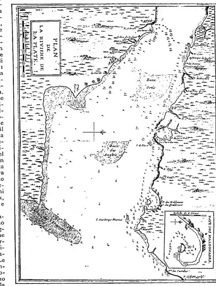
GEOGRAFIA - Planimetry of the Río de la Plata drawn by L. Feuillée, engraved by P. Giffart.
In 1933, Hassinger proposed a classification scheme consisting of 43 landscape types (Landschaftstypen), a simplification of an earlier essay by Passarge. Recently, in Italy, R. Biasutti (1947) described the main types of terrestrial landscape with references to human life and activity. Today, geographical research is directed in many states by dedicated national bodies affiliated with the Union géographique internationale, which promotes studies, research, and congresses. The major collaborative geographical works are: La géographie universelle (formerly directed by P. Vidal de la Blache); the Handbuch der geogr. Wissenschaft (directed by R. Klute); and the G. universale (directed by R. Almagià).
The institutions in Italy engaged in geography are: the Società Geografica Italiana (Rome), the Società di Studi Geografici (Florence), the Istituto Geografico Militare (Florence), the Comitato Nazionale per la g. within the Consiglio Nazionale delle Ricerche (Rome), the Istituto Idrografico della Marina (Genoa), the Touring Club Italiano (Milan), and others, all of which publish periodicals of scientific interest.
V. GEOGRAPHY AND ITS SUBDIVISIONS
In the current scientific framework, geography can be divided into several major sections.4. Physical geography (physiogeography)
Physical geography may be defined as the science that studies the physical facts and phenomena occurring on the Earth's surface (including marine spaces), examined from the perspective of their extent and mutual relationships. Knowledge of the Earth's shape, dimensions, position, and movements is indispensable general information. The geographical consequences of these facts are manifold, and while one of Humboldt's essential merits was to have, in the practice of observation, redirected geography toward the study of reality, the first element of É. Reclus's success and his fortunate influence on the spread of geographical interest was his profound sense of that activity which animates the Earth's surface with a kind of physical life.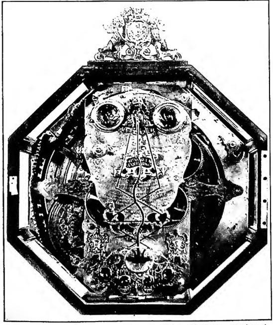
GEOGRAPHY - Farnese Planisphere, donated to Leo XIII by the Count of Casetta - Vatican Library.
a) Terrestrial morphology (geomorphology). - It deals with the major features of the Earth (geochemical constitution of the globe, distribution of lands and waters), investigates the genesis of reliefs on emerged lands in relation to their location and determining causes, traces the effects of exogenous dynamics on shaping, studies coastal topography, the influence of rocks and tectonics on relief, and thus all factors that affect the essential features of the geographic landscape.
b) Oceanography. - It delves into the research of the physical characteristics of the sea, the composition of waters and the distribution of salinity, temperature, and water transparency, addresses motions, submarine relief, sea level, bathymetric research; studies the sea from a physical-chemical perspective (thalassography), the nature and development of living beings (thalassobiology). The first studies were conducted by the Bolognese scientist Luigi Ferdinando Marsili (1658-1730), a member of the Académie des Sciences of Paris, who in 1725 published his Histoire physique de la mer. Since then, this branch of studies has seen considerable development both in Italy and abroad.
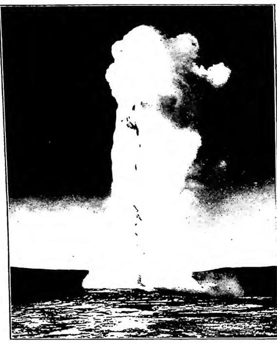
GEOGRAPHY - Manifestation of volcanic origin: the Old Faithful Geyser - Yellowstone Park (U.S.A.).
general laws of atmospheric movements, as well as the formation and path of disturbances (dynamic meteorology). It studies the localization of various meteorological phenomena, their interrelations, the influence of geographical conditions, and the relationships of these phenomena with the life and development of animals and plants, as well as with human hygiene and public health (climatology). It deals with studies concerning the free atmosphere, that is, the air layers not in contact with the ground (aerology). Meteorology thus encompasses the vast field of study of the entire gaseous mass surrounding the Earth, the pressure it exerts, isobaric types, temperature, solar radiation, hydrometeors; and in particular, it examines the functions and geographical distributions of the latter.
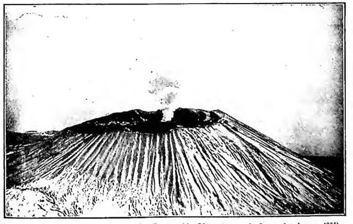
e) Volcanology. - It seeks to investigate the causes and effects of the superficial layers (subaerial and submarine) of the globe, from which materials from deep rock layers continuously or intermittently emanate (volcanoes). It identifies points of volcanicity, recognizes in some similar secondary or pseudovolcanic phenomena, in others postvolcanic phenomena, and studies their distribution across various regions of the Earth.
f) Glaciology. - It concerns itself with glaciers, their structure, oscillations, cycles, movements, and their geographical distribution; these studies, which began with scientific intent only at the end of the 18th century (the Swiss geologist and physicist Horace Benedict de Saussure [1740-99] was the pioneer of scientific mountaineering), later aimed to classify glaciers into types, to mark their characteristics, to study their parts, collecting and ablating basins, registration, etc.
g) Potamology. - It studies the action of surface waters, particularly rivers, their elements, phenomena of erosion, deposition, etc., and the cycles of hydrographic basins.
h) Limnology. - It aims to study the nature, origin, and life of lake basins, relief, hydrology, soundings, bathymetric maps, movements, temperature, transparency, water composition, climatic and topographic influences, oscillations, etc. A subsidiary branch of oceanography, limnology addresses the same problems, which it resolves using the same methods. Systematic studies in this field have greatly developed in recent times.
All branches of physical g., while forming an integral part of it, aim for a certain autonomy, which, however, cannot disregard the foundational consistency of physiogeography, the first part of g. proper, and which, even while abstracting from human activity, forms the basis of human g., a branch, in turn, of organic or biological g.
5. Human G
It studies the distribution of humans on the Earth's surface and their activities, investigating quantitative (density, population distribution) and qualitative (differentiation into races [types]) characteristics and variations, all of which constitute indices of series of interconnected physical, biological, and economic facts.Human g. has subgroups:
a) Ecological G. - It applies the principle of correlation, whereby humans are influenced by their surrounding environment. Here, g. employs ecology, properly concerning itself with the study of the relationships between living organisms and their surroundings, and of the peoples composing present-day humanity, based on linguistic, cultural, and social data of humans as modifiers of the environment (thus transitioning from a natural or unmodified landscape to a human or modified landscape), utilizing mineral, animal, or plant resources.
b) Economic G. - Drawing on merchandise science and economics, autonomous disciplines that particularly address the distribution of products, their commercial value, etc., it studies the utilization of terrestrial resources by humans. Parts of economic g. may be considered: commercial g., which studies economic phenomena in relation to the land (and which can be subdivided into g. of production and g. of consumption); and industrial g., which concerns itself with the distribution of raw materials and the possibilities of their transformation into pro-
(da Images de Grande-Bretagne, British Council s. a.)
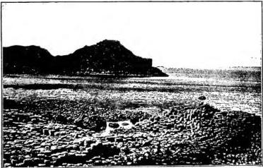
GEOGRAFIA - Basaltic lava flow with columnar jointing, Northern Ireland.
c) Political geography. - Examines the modifications that humans make to the Earth's surface by living in complex societies (States), determining borders, protective works, development, and conservation.
d) Ethnographic geography. - Investigates the causes and formative processes of peoples and their languages, modes of human life, natural growth, and migrations.
A particular study within ethnographic geography is that of the distribution of religions, which, due to their complexity and influence on other human activities, have given rise to the formation of geography of religions.
e) Geography of civilization. - Concerns all manifestations of human activity that have altered the natural state of the Earth's surface, shaping the artificial landscape of civilization in the distribution of major types: geography of settlements, geography of communications, geography of traffic. The geographical study of the city is called urban geography.
3. Aesthetic geography. - Aesthetic geography is also discussed, of which A. von Humboldt, F. Ratzel, and G. Pennesi may be considered exemplars when, in describing human works in their regional coexistence, geographical subjects are treated synthetically and artistically, yet with absolute scientific rigor.
4. Tourist geography. - A separate chapter could be constituted by tourist geography, which coordinates the geographical elements representing the dominant factor in the problem of tourism, understood internationally and socially.
5. Historical geography. - Aims to highlight changes that occurred in past eras. It also makes use of toponymy, which is the glottological elaboration of proper names of places and historical regions denoting particular natural and human conditions.
However, it is necessary to draw from these sciences discreetly, without losing sight of the principle of localization and extension, proper to geography, which, if overlooked, would cause it to lose part of its character as an autonomous science.
6. Botanical geography. - Botanical geography refers to the classification and distribution of plant formations on the globe.
For botanical geography in the strict sense to be discussed, one must await the definition of the plant species given by Linnaeus in the mid-18th century. The ancients possessed knowledge regarding the origin and cultivation requirements of useful plants; but with Linnaeus, the first floras compiled according to scientific criteria emerged.
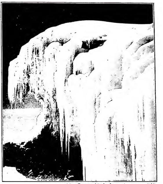
GEOGRAFIA - Ice cascade (serac) due to a rock step (Cima Margherita, Ruwenzori, National Park). Belgian Congo.
Humboldt thus laid the foundations for more specific research; A. P. de Candolle (1826) divided the Earth's surface into natural floristic regions; J. Schouw described the relationships between vegetation forms and habitat.
From the concept of flora, which is the complex of plant families in relation to their ecological or environmental characteristics—a relationship from which floristic regions are named (the Holarctic Eurasian or American, the Mediterranean, the North-Tropical desert of the Old World, the intertropical, the Austral)—one moves to the concept of the formation of vegetation zones. An association of plants with common biological characteristics constitutes formations (forests, steppes, tundras), which can be aquatic or terrestrial. Among the vegetation zones are those of hot climates, with the equatorial rainforest (an almost continuous, impenetrable mantle of arboreal vegetation) and the savanna; those of subtropical climates, with Mediterranean forest and scrub (with a dual vegetative resting period), steppe, and Chinese forest; those of temperate climates, with the boreal forest of broadleaf and coniferous trees, with
GEOGRAFIA - The main crater of Vesuvio - Napoli.
(from Universa, Rivista dell'Istituto Geografico Militare Generale, February 1858, extra plate p. 161)
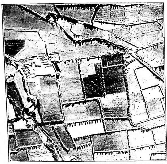
GEOGRAFIA - Aerial view of tree-lined roads. From the shadows, one can deduce the species of trees.
the prairie and the steppe-prairie; that of cold climates, with the characteristic tundras.
Among the geographical factors of plant distribution, climatic factors must be considered: light, heat, humidity, wind, variously distributed; physical factors, due to the physicochemical conditions of the soil on which plants live; and organic factors, related to the living conditions of saprophytism, commensalism, or symbiosis of plants to the advantage or disadvantage of others with which they coexist.
7. Zoological G
Examines in particular the characteristics of the fauna found in the various regions of the Earth, divides the Earth into regions and subregions, and highlights zoogeographical affinities.Among the divisions that have a scientific character, the one proposed by Ph. L. Sclater (1857) is noteworthy. Numerous attempts were made to classify zoogeographical regions. Among the most successful was that of A. R. Wallace (1876), who recognized the following regions: Palearctic (with the subregions European, Mediterranean, Siberian, and Manchurian), Ethiopian, Oriental (Indian, Ceylonese, Indo-Chinese, Indo-Malayan), Australian (Austro-Malese-Polynesian, New Zealand), Neotropical (Chilean, Brazilian, Mexican, Antillean), and Nearctic (Californian, Canadian, Rocky Mountains).
Among other classifiers of zoogeographical regions, F. E. Beddar (1895) and L. Trouessart (1922) stood out; G. Colosi, H. Woodnard, and A. Günther delimited marine zoogeographical regions.
Considering the animals that populate the Earth's surface, three great ecological domains are distinguished: the halobios or marine, the limnobios or freshwater, and the aerobios or terrestrial. In the first, where life is believed to have originated, given that environmental conditions there are least distant from those that would support this view, representatives of all types of the animal kingdom live.
The other two domains possess genera and families exclusive to them; the systematics of their faunas provide significant contributions to the marine genesis of the elements that constitute them. With respect to distribution areas, there are groupings that occupy vast expanses, while others are confined to very restricted areas.
VI. SCIENTIFIC GEOGRAPHY AND AS A COORDINATING SCIENCE
The term scientific geography has been used to designate the speculative and theoretical part of this science, distinguishing it from what might be called exploratory geography, which, being experimental, retains its empirical character. A group of English geographers referred to it as the "study of local correlations," while in Italy G. Dalla Vedova asserted that "geography pertains to the distributive and chorological moment of the sciences." Between the late 18th century and the first half of the 19th, the dualism between the two distinct approaches—naturalistic and historical—had delayed the establishment of scientific geography. The conflict between general physical geography and chorography concerning man (in which regional history and states form the central part) disappears, or at least begins to fade, with the new evolution of geographical science, in which causal investigation prevails. The unity of the geographical perspective requires that geography be recognized as a unitary science, a "monistic" science.Thus, geography's merit lies, unlike other sciences which do not contemplate the material and ideal unity of the Earth, in recognizing within it a new function of reference, control, and correlation among the various sciences, which, until then separate and autonomous, had remained without the possibility of synthesis.
As a coordinating science, geography is not geology; it is not statistics, not history, not topography, not biology. It must hold its place among the unifying sciences, and to geology, statistics, history, topography, and biology, it provides the spatial element—the Earth's surface, the abode of man and the theater of his activities. The universality of geography allows it to delve into the search for the ultimate causes of nature, just as philosophy seeks the ultimate causes of the idea, without, however, confusing the two, as geography remains in the speculative-practical field, in closer contact with the experimental, social, and historical sciences.
VII. GEOGRAPHY, RELATED AND AUXILIARY SCIENCES
Geography is in itself a complete science: it simultaneously studies history, physics, chemistry, zoology, botany, meteorology, etc., embracing an extremely vast field that extends from ethical sciences (history, politics, etc.) to those more strictly scientific and natural (geology, chemistry, botany, etc.). No other science synthesizes as many disciplines as geography, nor does any other require so many auxiliary sciences.In modern geography as a scientific organism, cosmography and cartography are no longer included, as these now belong to the group of physical or mathematical disciplines, both in terms of their purpose and their methods of study. They deal with subjects that were once, and still partly are, the object of mathematical geography or astronomical geography. The latter considers the Earth as a celestial body with a defined shape, dimensions, and motions, studies its position in the cosmos, and above all its relations with the solar system. Modern geography, in the strict sense, makes use of the preliminary notions of what constitutes astronomical geography and of the knowledge of procedures for constructing geographical maps (v. above, III).
However, the geographer must possess knowledge of other sciences related to and auxiliary to geography.
Statistics, a mathematical and social discipline, collects, examines, processes, and classifies numerical data on populations and their activities, tracking the trends of demographic phenomena and providing material for geography, which studies, among other things, the distribution of living beings on Earth.
Geology (v.) investigates the constitution and structure of the Earth's crust, in which phenom-
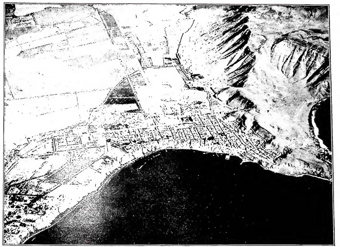
GEOGRAPHY - Chorillos, seaside beach of Lima. Example of aerial photography illustrating the morphology of the landscape - Peru.
is of an essentially physical order. Geology (v.) investigates the constitution and structure of the Earth's crust, in which physical and human phenomena act; subject to continuous evolution, it constitutes a true history of the Earth.
Lithology studies the origin and nature of the rocks forming the Earth's crust.
Paleontology deals with the study of fossil organisms contained in the Earth's surface, determining, through a comparative process, the era to which they belonged.
Tectonics and stratigraphy are peculiar in the study of the disposition of materials, for the correlation of the principles of action and reaction.
Anthropology describes the racial characteristics of the various human groups distributed across the Earth's surface.
Paleontology and ethnology deal with the cultural characteristics, customs, and lifestyles of various peoples; the former studies prehistoric chronology, providing frameworks of the different forms through which human civilization developed.
Among the auxiliary sciences are history, politics, ethics, law, economics, philology, glottology, archaeology, psychology, mineralogy, zoology, botany, mathematics, chemistry, merchandise science, medicine, etc., which, although not having a direct and immediate relation with geography, nevertheless maintain a necessary logical and practical connection with II. - See plates IV-V. BIBLICA.: History of geography: E. Tozer, A history of ancient geography, Cambridge 1897; G. Marinelli, Metodo e storia della g., in Scritti minori, I, Firenze 1908; C. Errera, L'epoca delle grandi scoperte geografiche, Milano 1926; J. N. L. Baker, A history of geographical discovery and exploration, Londra 1931; G. Caraci, Tabulae geographicae vetustiores in Italia adverzatae, Firenze 1927-32. - Writings on methodology and general geography: F. V. Richthofen, Aufgaben und Methoden der heutigen Geographie, Lipsia 1883; S. Günter, Entdeckungsgeschichte und Fortschritte der wiesenach, Geographie im XIX. Jahrh., Berlino 1902; G. Dalla Vedova, Scritti geografici, Novara 1914; R. Almagià, La g., Roma 1919; C. Vallaux, Les sciences géographiques, Parigi 1919; R. Almagià, La g. guida bibliografica, 2ª ed., Roma 1922; H. Wagner, Lehrbuch der Geographie, Hannover-Lipsia 1923; A. Lorenz, Introduzione alla g., Bologna 1943; R. Biasutti, Il paesaggio terrestre, Torino 1947; A. R. Toniolo, Definizione, oggetto, metodo della g. attuale, in Introduzione allo studio della g., Milano 1947, pp. 33-94; R. Almagià, s. v., in Enc. Ital., XVI, pp. 602-17. - Particular geography: A. R. Wallace, The geographical distribution of animals, Londra 1876; O. Peschel, Geschichte der Erdkunde bis auf A. V. Humboldt u. C. Ritter, Monaco 1877; A. J. Herbertson, The major natural regions, in Geogr. journal (1905), pp. 300-12; J. Brunhes, La géographie humaine, 3ª ed., Parigi 1912; F. Ratzel, La g. de l'homme, Torino 1914; A. Supan, Leitlinien der allgem. polit. Geographie, Lipsia 1923; G. Chisholm, Handbook of commercial geography, Londra 1925; O. Maull, Polit. Geographie, Berlino 1925; E. Huntington, The human habitation, Londra 1928; S. Passarge, Die Erde und ihr Wirtschaftsleben, Amburgo 1929; C. Streit, Atlas hierarchicus, Friburgo in Br. 1929; M. Prenant, Géographie des animaux, Parigi 1933; U. Toschi, Studi di morfologia urbana, Bologna 1933; A. F. W. Schimper, Pflanzengeographie, 3ª ed., Jena 1935; U. Toschi, Temi di g. economica, Bari 1938; D. Gribaudi, Ambiente fisiogeografico ed ampiezza della proprietà terriera, Torino 1938; R. Almagià, Elementi di g. economica generale, Milano 1947. - Cartographic sources: A list of geographical atlases in the Library of Congress, edited by F. Lee Phillips, 4 voll., Washington 1909-20; O. Marinelli, Atlante dei tipi geografici, Firenze 1922; Istituto geografico De Agostini, Grande Atlante, 4ª ed., Novara 1938; Touring Club Italiano, Atlante internazionale, Milano 1929; G. Caraci, Geografiche (carte), in Enc. Ital., XVI, pp. 617-19; M. Eckert, Kartographie, Ihre Aufgaben und Bedeutung für die Kultur der Gegenwart, Berlino 1939; G. Dainelli, Atlante fisico-economico d'Italia, Cons. Tur. Italiana, Milano 1939; M. Emiliani e R. L. Papocchia, Nozioni di cartografia e avviamento alla lettura delle carte, Roma 1941; Piccolo Atlante Marinelli, Milano 1943; A. Sestini, La lettura delle carte geografiche, Firenze 1944; L. F. De Magistris, Fonti geocartografiche moderne, Milano 1944; R. Almagià, Monumenta Cartographica Vaticana, Città del Vaticano, Biblioteca Apostolica Vaticana 1944-48. Gastone Imbrighi