
AMERICA. – Weekly periodical, published in New York by Jesuits chosen from the American provinces of the Order. Founded in 1909 as a replacement for the monthly Messenger, it always retained the character of a “weekly review” from a Catholic standpoint. To supplement the work of A., which was more journalistic in character, in 1925 the editors began publishing a quarterly review of a high-level popularizing nature, Thought (later transferred to Fordham University), and America Press became the publisher of a number of books on piety, religious formation, and American ecclesiastical history. A. has proved to be one of the most influential organs shaping Catholic opinion in the United States.
AMERICA. - One of the five largest continents of the Earth, divided into three parts: northern, central, and southern.
CONTENTS: I. GEOGRAPHY: 1. North and Central America;
2. South America
II. ETHNOGRAPHY
III. ECCLESIASTICAL HISTORY: 1. Pre-Columbian era; 2. North America: Canada, United States; 3. Spanish America; 4. Portuguese America.#### I. GEOGRAPHY
3. NORTH AND CENTRAL AMERICA
By convention, North A. includes not only the great boreal mass of the New World, from the Pole to the Tropic, but also the long, narrow isthmian region and the insular arcs (Central A.) that connect it to the analogous continental mass extending south of the equator. Within these limits (from 72° to 6° N., i.e., up to the Isthmus of Darien) and including, as is customary, Greenland (which extends north to 83° 23'), North America measures 24 million km², of which over one-quarter belongs to its articulations (17% to the islands; and of these, 9% to Greenland), mostly located, however, in zones of little anthropic significance or even anecumenical (Circumpolar Archipelago). The parts of the continent closest to the Old World are the northern ones, where the mass attains its greatest length (ca. 6000 km) from Alaska to Labrador; toward the south, instead,while this narrows (in the Isthmus of Panama the land bridge between the two oceans measures just over 50 km), distances increase considerably both toward Europe (3200 km between Iceland and Newfoundland instead of the 1500 between Greenland and Norway) and toward Asia (92 km in the Bering Strait). Between 30° and 10° N., on the western side of the continent, a vast mediterranean opens, which the insular arcs divide into two basins (the Gulf of Mexico to the north and the Caribbean Sea to the south) and which exerts a decisive influence on the entire life of the New World.
North America has, among all parts of the world, the highest percentage of coastline in relation to its surface area: of the two sides facing the open oceans, the eastern is by far the more accessible and frequented, though it becomes flat south of Cape Cod, marshy beyond Cape Hatteras, and especially along the Gulf of Mexico. On the western side, mountains loom everywhere; south of California, ports of any significance are virtually absent.
The continent’s architecture rests on relatively simple lines. To the west, a series of reliefs extends from Alaska to the isthmian region, which can be grouped, schematically, into a triple order of Cordilleras: two external, proximate and parallel to the Pacific (one coastal, separated by a series of depressions from a subcoastal, which bears different names from zone to zone), and one internal (the Rockies), which diverges increasingly as it approaches its terminus around 35° N. Between these and the first two lie plateaus and enclosed basins, often arid, traversed by deeply incised rivers (Alaska, Great Basin, Colorado Basin), which reach their greatest extent in the territory of the United States. Though locally higher than the Alps (Mt. McKinley, 6187 m), these mountains present, even in their culminating areas, less rugged forms than the Alps, as well as less abundance of ice, water, and forests, except in the northernmost sections, where the external Cordilleras assume the typical glacial morphology and align a notable number of volcanic apparatuses.
The eastern relief (Alleghenies, or Appalachians) exhibits a very different structure and character, being much less extensive in breadth (1500 km in length, 80-100 in width) and consisting of folds and plateaus representing the remnants of older uplifts; with rounded ridges and peaks, gentle forms and slopes, and thus a more hilly than mountainous landscape (heights generally below 2000 m).
South of the Rio Grande do Norte, structure and characteristics change: a great plateau (Mexico), whose elevation ranges between 1000 and 1500 m, is enclosed on its sides by two mountain barriers (Western Sierra Madre and Eastern Sierra Madre), which continue on one side into the isthmian region and on the other into the insular region of the Antilles, in both cases with frequent interruptions and extensive volcanism, especially on the Pacific-facing slope.
The continent’s hydrography is clearly related to its structure. Arheic and endorheic zones withdraw only 15% of the territory from surface circulation; elsewhere, few but vast river basins are organized in correspondence with the great zone of internal lowlands, given the disposition of the reliefs and their proximity to the opposite shores of the two oceans.
(du Three centuries of Mexican colonial archit.)
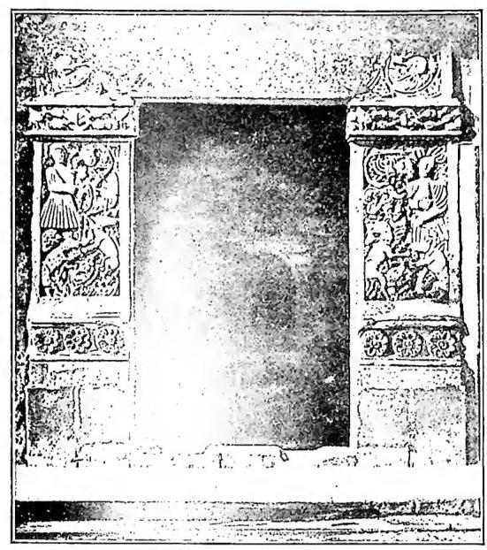
AMERICA - Sculpted portal (16th century) - Puebla (Mexico).
However, while the northern slope of this zone, broader and more rugged, divides its waters among the basins of the Mackenzie (1.7 million km²; 4,600 km in length), the St. Lawrence (1.2 million and 700 km respectively), the Nelson (1.1 million and 650 km), and the Yukon (0.9 million and 3,290 km), the southern slope channels them into the single vast system of the Missouri-Mississippi (3.2 million and 6,300 km), in which, however, the most substantial headwater branch is undoubtedly the Ohio, shorter (1,560 km) than the Missouri (4,800 km) but endowed with a flow rate more than double that of the latter. Canadian rivers have abundant and constant waters, fed as they are by lakes, some of which rank among the largest on Earth. The five that feed the St. Lawrence cover, between 41° and 49° N (at a latitude comparable to that from Naples to Paris), an area twice that of the Adriatic, which largely compensates for the limited utility of the great fluvio-lacustrine systems of the regions north of the 50th parallel. Nevertheless, it should not be forgotten that their commercial outlet corresponds less to the mouth of the St. Lawrence, frozen for an average of five months per year, than to that of the Hudson, toward which they have been artificially directed by means of canals.
Given its latitudinal extent (65°), North America presents notable climatic varieties. Their general character, compared to those of Europe, is primarily greater continentality, from which only more or less narrow coastal margins are excluded. Aside from the peri-Arctic zone (which has long and extremely harsh winters), short summers, and scarce precipitation, excessive thermal regimes with strong annual and seasonal variations are common even in temperate zones: New York, which lies at approximately the latitude of Naples, has an average winter temperature of -1°C and a summer temperature of 23°C (Naples: 9.2°C and 23.5°C respectively), which become -4.6°C and 22.4°C in Chicago (at the latitude of Rome), and -13.4°C and 17.7°C in Duluth, Minnesota (at the latitude of Bolzano). Such conditions dominate the Atlantic slope under the influence of the cold Labrador Current and the central plains, where both cold currents from the north and warm currents from the south have free play. Along the Pacific, however (from approximately 50° to 35°), a climatic type similar to that of the Mediterranean is realized, with mild winters, cool summers, and predominantly winter rainfall. The other western lands have a dry and harsh climate; aridity, which generally increases from the two oceans toward the interior, reaches its maximum in the enclosed basins between the southern offshoots of the Cordilleras (Death Valley, Colorado and Gila Deserts). A dry but mild climate, with weak thermal variations, prevails in the interior of Mexico; on the Atlantic coasts, as in Central America and the West Indies, the climate shifts to tropical oceanic, with high average temperatures and abundant rainfall, locally exceeding 4,000 mm annually. Where altitude tempers thermal extremes (tierras templadas), settlement finds favorable conditions, even for whites, who, however, poorly tolerate the hot, humid, and unhealthy climate of the coastal regions (tierras calientes).
The same zonal pattern, from north to south, is found in the vegetal landscape. To the glacial desert of high latitudes (compact in the uniform plateau of Greenland) follows first the subarctic tundra (mosses, lichens, dwarf shrubs; more extensive toward the south than in the Old Continent) and then the coniferous forest, which covers large expanses of land in Canada and the Western Cordilleras, while the deciduous forest, which once covered all the United States east of the 90th meridian, has almost everywhere given way to cultivation. But the greater part of the central plain region lies within the domain of the steppe, which transitions from true grassy prairies without trees to increasingly poorer forms as one moves westward and southward. Finally, from Florida to Darién, the characteristic tropical vegetation rapidly develops, first with the savanna, then with the forest: lush woods, with extensive undergrowth, persist even in the regions of the tierras templadas.
The population of North America within the aforementioned boundaries today exceeds 200 million inhabitants; the resulting average density (8 inhabitants per km²) reveals a strong imbalance between vast regions that are entirely (Arctic islands, Greenland) or almost entirely (Alaska, northern Canada, arid western plateaus) uninhabited and much more restricted areas that are fairly (United States between 37° and 44° N) or even very densely (Antilles) populated. The highest densities (Puerto Rico 200, Barbados 500 inhabitants per km²) are nevertheless far from the figures of Eurasian countries, also because these densities themselves are related to the varying antiquity of settlement and the progress of colonization.
Even in religion, the contrast between Catholic Neo-Latin civilization and predominantly (though not exclusively) Protestant Anglo-Saxon civilization is clearly reflected. And since the area of the latter corresponds to the temperate regions of greater demographic density, against one-third of Catholics (primarily Mexico and Central America), North America records approximately two-thirds of adherents to non-Catholic Christian denominations (Canada and the United States; in the latter,
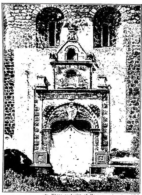
AMERICA - Portal of the church of the Franciscan convent (16th century) - Xochimilco (Mexico).
In the political sphere, while the northern countries are unified into just two large federal organizations (Canada and the United States), each nearly as vast as the whole of Europe, the southern ones have seen the original Spanish dominion disintegrate into numerous but small units, more or less independent (in fact) or subject to other states, except for the extensive, also federal, complex of Mexico. The territories under European dependence are now reduced, aside from the Canadian Dominion, almost exclusively to islands: among these, only the British ones (Newfoundland, Jamaica, Bermuda, the Antilles) retain considerable economic value. Spain was entirely eliminated from these possessions; France and the Netherlands retain only a few remnants. Denmark holds the vast but icy Greenland.
Here is the current political overview of North and Central America:
#### NORTH AND CENTRAL AMERICA
| States and possessions | Area (sq. km.) | Population |
|---|---|---|
| Costa Rica | 49,827 | 746,500 |
| Cuba | 114,524 | 4,779,000 |
| Dominican Republic | 50,070 | 1,970,000 |
| Guatemala | 109,724 | 3,457,000 |
| Haiti | 27,844 | 3,500,000 |
| Honduras | 115,570 | 1,201,000 |
| Mexico | 1,963,677 | 22,227,000 |
| Nicaragua | 118,453 | 1,381,000 |
| Panama | 74,010 | 678,000 |
| El Salvador | 34,126 | 1,997,000 |
| United States | 7,997,000 | 141,229,000 |
| Independent states | 10,654,825 | 183,355,000 |
| Alaska | 1,518,717 | 134,000 |
| Puerto Rico | 8,896 | 2,083,000 |
| Canal Zone | 1,422 | 48,350 |
| Virgin Islands | 344 | 25,000 |
| Various dependencies | 133 | 1,000 |
| U.S. possessions | 1,529,512 | 2,291,000 |
| St.-Pierre et Miquelon | 241 | 4,300 |
| Guadeloupe and dependencies | 1,780 | 310,000 |
| Martinique | 1,106 | 255,000 |
| French possessions | 3,127 | 569,000 |
| Dutch Antilles | 76 | 4,200 |
| Dutch possessions | 76 | 4,200 |
| Greenland | 2,175,000 | 18,000 |
| Danish possessions | 2,175,000 | 18,000 |
| Dominion of Canada | 9,569,289 | 12,307,000 |
| Newfoundland | 110,677 | 300,000 |
| Labrador | 306,800 | 5,000 |
| British Honduras | 21,268 | 64,300 |
| Bermuda Islands | 49 | 34,400 |
| Bahama Islands | 11,405 | 73,000 |
| Jamaica and dependencies | 12,225 | 1,250,000 |
| Lesser British Antilles | 3,651 | 600,000 |
| British possessions | 10,035,000 | 14,633,700 |
| TOTAL NORTH AND CENTRAL AMERICA | 24,397,540 | 198,859,900 |
The North American continent now has no rivals in terms of economic development. Its inexhaustible natural resources have stimulated the use of the most modern and rational means of exploitation. Large-scale industry is represented by some of the most gigantic and efficient concentrations in the world. Moreover, while the exploitation of its reserves is still capable of broad expansion (excluding the cold northern zones and the arid western ones), its population is far from exhausting production, a more or less substantial margin of which fuels export flows in every sector.
Agriculture provides the following shares of the world's total production (1934–38 average): 16.6% of wheat; 48.8% of maize; 29.3% of oats; 43.7% of cotton; 29.5% of cane sugar; 22.5% of tobacco; 12.4% of barley; and considerable quantities of potatoes, rice, soy, peanuts, etc. This production is concentrated mainly in the United States and southern Canada. The same countries (western and northern regions) account for almost all of the continent's vast forest reserves (35.3% of Canada's land area; 26.1% of the United States'). Canada and the United States alone contribute one-third of the world's timber exports.
Livestock farming is also practiced on a very large scale; the continent's stock includes (in millions of head, with percentages of the 1934–58 world total in parentheses): 92.8 (14.8) cattle; 63.7 (8.6) sheep; 16 (6.8) goats; 69.3 (20.9) pigs; 16 (19.2) horses. Livestock regions are primarily the vast prairies of the United States and Canada, where mixed farming (with agriculture) prevails in the east, while in the west, open-range cattle grazing dominates in the north and sheep in the arid southern mountains. Fishing also assumes considerable importance, both maritime—along the Pacific coast (northwest) and the Atlantic coast (Canada and the United States)—and fluvial (tributaries of the Pacific) and lacustrine. At least two-thirds of the world's marine fishing products come from North America.
North America, and especially the United States, holds the lead in almost all mineral products, with fuels at the top; it produces 70% of the world's oil (Texas, Pennsylvania, California; reserves account for over 50% of the global total), about 50% of coal (Allegheny, western Canada), two-thirds of sulfur (Texas, Louisiana), nearly two-thirds of iron ore (Allegheny, Great Lakes), half of lead, zinc, and aluminum, more than half of copper, two-thirds of silver (Mexico, Alaska, the Rockies), and one-third of gold (Canada, Alaska, California).
Favored by these immense riches, North American industries (but almost exclusively in the United States and Canada) have made decisive progress in every sector, distinguished by the modernity and grandeur of their technical equipment, the extensive and rational use of machinery, specialized and mass production, the responsiveness of products to demand, the high standard of living afforded to workers, and their concentration in districts and large centers, which has simultaneously generated active commercial flows toward every part of the world. This development has also been made possible by the impetus given to transportation, with railways (525,000 km; about two-fifths of the world's total network; eight major transcontinental lines allow travel from the Atlantic to the Pacific in 3–4 days), motor vehicle services (North America produces over four-fifths of the world's motor vehicles), and air communications, in which the continent also holds a global primacy (over 100,000 km of regularly operated routes). As for foreign trade, it suffices to note that North America today possesses more than half of the world's ships (40.5 million gross tons in the merchant fleet of the United States alone); among its ports, both on the Atlantic (New York, New Orleans, Boston, Philadelphia, Baltimore, Montreal, Quebec, Havana, etc.) and the Pacific (Los Angeles, San Francisco, Seattle, Portland, Panama), are some of the most active and frequented emporia in the world.
Scholars' calculations foresee a possible population increase that could multiply the current figure by four to six times.

4. SOUTHERN A
Despite forming a single continental mass with Northern A., to which it bears resemblance in many respects, Southern A. constitutes a well-defined continent: the most isolated from all others, the one reaching the highest southern latitude; of all, the least articulated and at the same time the one in which the contrast between longitudinal development (maximum of 5,100 km between northern Peru and Brazil), which gradually narrows toward the south, and the far more considerable latitudinal development (from 12° to 56° S; 7,500 km) is most pronounced. Covering 18 million km², Southern A. extends only slightly more than one-quarter south of the Tropic: the remainder, that is, 73% of its territory, lies within the intertropical zones, the largest portion (56%) of which is south of the Equator.As in Northern A., a median depression separates two elevated marginal sectors, of charac-
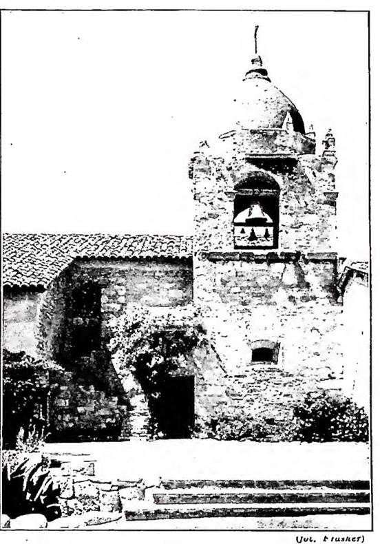
AMERICA - California, Mission of Carmel (18th century).
character and appearance, of which the western one extends compactly along the Pacific, without allowing for coastal plains. Continuing from the Caribbean Sea to Tierra del Fuego, these western reliefs (Andes or Cordilleras) consist of multiple ranges of ridges pressed against one another; initially arranged in a fan shape and enclosing longitudinal valleys (Andes of Colombia), they then widen to include more or less extensive and elevated (up to 3-4 thousand meters) plateaus (Andes of Ecuador, Peru, and Bolivia), and finally assume the form of a single mass (Argentine-Chilean and Patagonian Andes). Almost everywhere, the Andes are faced along the coast by lesser reliefs, which, though discontinuous, locally take on considerable importance, especially in Chile, where, between them and the Cordilleras, a long longitudinal depression is found, submerged at its southern extremity. Also toward the interior, the true Andes are flanked (in northwestern Argentina) by precordilleras that isolate closed basins and river valleys. Narrower than the
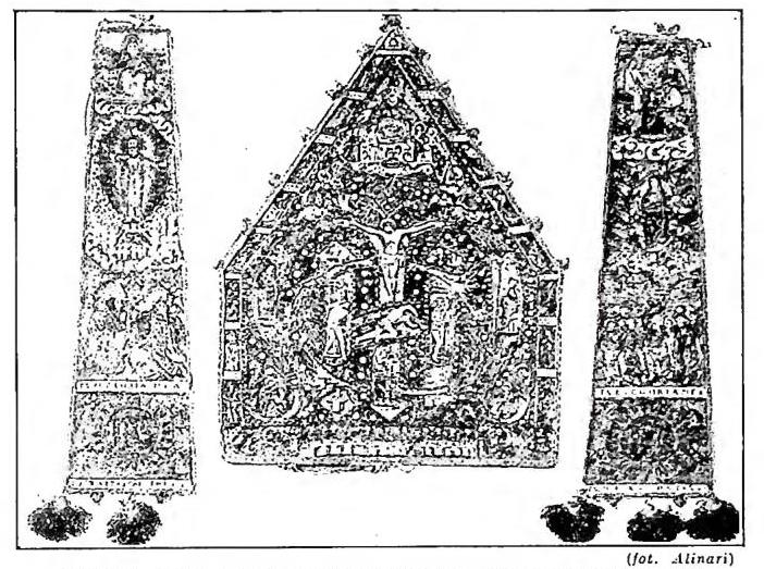
AMERICA - Idol in chrysoprase (Central America).
The Rocky Mountains, though generally higher, are surpassed in elevation by the Andes; summits exceeding 6,000 meters are numerous (Aconcagua, the highest, surpasses 7,000), and most correspond to the frequent volcanic edifices that constitute another characteristic of the system. The passes are typically very high and only descend toward the south, where (Patagonian Andes) glacial erosion has left its imprint on both slopes.
On the side of the continent facing the Atlantic, the relief consists instead of plateaus that take on the appearance of mountains only along their delimiting margins, or toward the southeast along the Brazilian coast, or inland, above the depressions they overlook. The one through which the Amazon and its tributaries flow separates the Guiana Plateau, which ends at the Orinoco, from the much vaster Brazilian Plateau, deeply incised also by watercourses that flow directly into the Atlantic. Patagonia consists of a series of terraces descending from the foot of the Andes to the Ocean, whose indented coast is dominated by steep escarpments.
The greater part of the continent is finally occupied by lowlands, more united than divided by barely suggested thresholds among the three great river basins that contend for dominance (Orinoco, Amazon, Pa-
raná-Paraguay) in a single broad plain (not always of alluvial origin), elevated on average no more than 200 meters above sea level. Of the three rivers, the Amazon has by far the largest basin (over 7 million km²), indeed the largest on Earth; together, the three occupy two-thirds of South America, and with their tributaries—many of which surpass the largest European rivers—form magnificent navigable routes that allow passage from the Atlantic into the heart of the continent and up to the foot of the Andes. Lesser but not negligible importance is also presented by the other tributaries of the Atlantic (Madeira, Uruguay, São Francisco, Magdalena, etc.), and their affluents, though interrupted by rapids corresponding to the eastern plateau. The zones without drainage to the sea are reduced to less than a quarter of the continent and are all located south of 15° S and west of 60° W Greenwich.
Lakes are neither frequent nor conspicuous. The two largest (Titicaca and Poopò), of tectonic origin, are found on the Andean plateau; of the others, the most notable are located in the terminal section of the same system (southern Andes).
Although more than two-thirds of the continent lies within the torrid zone, and thus under the dominion of hot climates, South America enjoys moderate temperatures, thanks especially to the disposition of the relief, which widely permits the free interplay of oceanic influences. In regions north of the Tropic, the Atlantic trade winds determine the rainfall regime, which is generally very abundant (from 2,000 to 4,000 mm annually along the northeastern coast and in the middle Amazon basin) and concentrated either in a single season (varying depending on whether one is north or south of the Equator) or in two periods separated by a brief dry interlude (veranillo). Beyond the Tropic, temperatures decrease; seasonal contrasts increase, and the origin of moist air currents reverses. The westerly winds blowing from the Pacific inundate the ocean-facing slope with rain, while the side facing the inland plain benefits little or not at all.
The extreme southern tip has a very harsh climate, with long winters; but while precipitation ranges from 2,000 to 4,000 mm annually on the Chilean insular fringe, it decreases to less than 300 mm throughout Patagonia. Aridity then increases, also along the Pacific, from median Chile (ca. 27°-28°) to northern Peru, and affects, together with the territories on the reverse side of the Andes extending from the Bolivian puna to northwestern Argentina, an area vast in latitude but relatively narrow. The deserts of South America (Atacama) are thus proportionally incomparable to those of Africa. In the Andes, the exceptional elevation of the interposed plateaus tempers, in the heart of the torrid zone, thermal extremes: the countries of this sector enjoy a climate with minimal seasonal variations and were, in a pre-Columbian era, seats of advanced peoples, at the same latitudes as the Congo and Guinea.
The regions where rainfall averages 2,000 mm annually or more are characterized by equatorial forest (selvas), which also penetrates the lower eastern valleys and covers the Atlantic coastline from the Orinoco to the Tropic. Periodic zenithal rains correspond to sparse forest, leafless in the dry season (catingas of Brazil), which gradually transitions into savanna, often in the form of woodland with large clearings (campos), and more or less lush with shrubs (carrascos) or grasses (llanos of Vene-
zuela), the latter becoming sparse or disappearing entirely with increasing aridity (sertões of Brazil). The transition to temperate climates is marked by prairies (chaco), which gradually give way to the typical pampas of tall grasses (Argentina), and these in turn on one side to the increasingly poor and open forms of Patagonia, and on the other to the salt flats of the Andean foothills. In these latter vegetations, cultivation and human settlement are arranged in altitudinal bands roughly every 1,000 meters: tierras calientes, templadas, and frías; the tierras frías are sometimes forested. Above 3,000 meters, the high steppe of grasses and shrubs (páramos) typically begins.
The population of South America slightly exceeds 100 million inhabitants. This results in an average density of about 6 inhabitants per km², but the relative distribution is highly uneven, not so much in relation to the differing opportunities offered to human activity as to the progress of colonization, which here, unlike in North America, is still in full development. Only certain marginal areas are more densely populated, in
southern Brazil, Uruguay, eastern Argentina, central Chile, and the Andean plateaus; but most of the continent remains nearly devoid of population or with extremely sparse settlement. Of these 100 million inhabitants, more than half are white (Creoles and immigrants, 57-60 million), but at least a quarter (25 million) are mestizos, and over one-tenth are Amerindians, descendants of pre-Columbian Indios. The remainder (8 million) consists of Blacks and mulattos. The forced Black immigration began in the 18th century and ended only in 1851. Later, with the whites, Chinese and Japanese arrived in the Pacific states, and Indians and Malays in the Guianas: but their numbers are relatively modest. It is worth noting, however, that the relevant statistics, conducted with different criteria from state to state, are neither always reliable nor in every case comparable. In general, the indigenous population has remained, despite contact with whites, in the tropical Andes; groups of independent Indios survive in the Brazilian forest and Tierra del Fuego. Creole, Spanish, and Portuguese populations, heavily mixed with indigenous blood, occupy much of the eastern regions, also north of the Tropic; Blacks are numerous in the areas once dedicated to sugarcane cultivation and mining sectors. Following the initial Creole colonization, dense especially in the intertropical zone, came, at the end of the last century (with the development of large steam navigation), European immigration, which
directed itself toward the temperate regions, where it now also prevails numerically.
AMERICA - Idol in chrysoprase (Central America).
Southern America is almost entirely dominated by Neo-Latin peoples; its civilization is therefore essentially Latin and Catholic. Even among recent immigrants, the contribution of Spaniards, Portuguese, and especially Italians predominates, the latter currently numbering over 4 million. Notable, in some states (southern Brazil, central Chile), is the influx of Germans. The spoken language is everywhere Spanish, except in Brazil, where the official language is Portuguese. However, some indigenous languages (Guarani, Aymará, Quechua, Tupi, etc.) survive locally (inland Brazil, Andean region).
The religion has remained everywhere Catholic (96% of the continent's population), which continues to make converts among the Indios. These (Amazonian Brazil, Chaco, Patagonia), however, are largely fetishists (2.6% of the South American total). Protestants (0.8%) are essentially limited to German immigrants. Jews are in absolutely insignificant numbers, even fewer than those recorded as having no religion (0.1%).
In the mining sector, silver (Peru, Bolivia: 10% of world production), copper (primarily Chile; 1/4 of world production), tin (Bolivia), zinc (Peru, Bolivia), nitrates (Chile), aluminum (Guianas), and especially petroleum—whose extraction (Venezuela, and, at a great distance, Trinidad, Argentina, and Colombia) is rapidly increasing (12% of the world total)—are more important than gold (Colombia), which is in sharp decline.
Today, agricultural production and livestock farming carry far greater weight in the continental economy. Over three-quarters of the world's coffee harvest comes from Southern America, which also supplies large quantities of cocoa (26%), sugarcane (13%), cotton (9%), tobacco (5%), cereals, etc. Cattle (over 100 million head) represent 15% of the world total, sheep (100 million head) 14%, horses 20%, pigs 11%, etc.; significant quantities of frozen and preserved meats, meat extracts (70% of exports), etc., are produced.
Forest resources are immense (Brazil) and still barely tapped (rubber, timber, medicinal essences).
Despite this, the South American economy remains centered on the surplus of widely consumed raw materials, which allows it to balance the demand
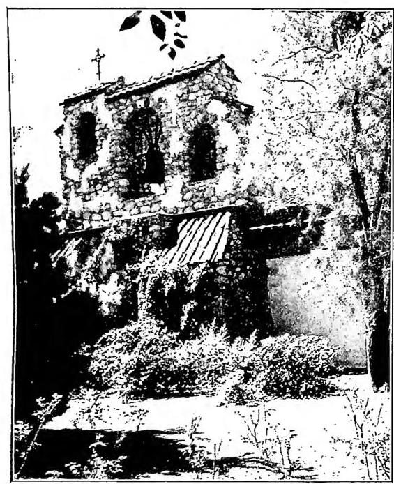
### AMERICA - California, Mission of San Michele (founded in 1797) - Bell tower.
of industrial products. The overly modest availability of fossil coal (the imposing water reserves are still almost entirely untouched), the sparse population and consequent scarcity of labor, and the insufficiency of transportation means have hindered and continue to hinder the development of modern large-scale industry, capable of meeting internal demand only in some regions (Argentina, Chile, southern Brazil) and for certain industrial sectors (food, timber, textiles, chemical products, etc.).
Only Argentina, Chile, and southern Brazil possess sufficiently developed railway networks, but the entire continent, with its 103,000 km of lines—of which slightly less than half are in Argentina alone—accounts for less than 8% of the global total. Moreover, much of these railways consist of penetration lines, without reciprocal connections and with different gauges. Five independent branches ascend from the Pacific coast onto the high Argentine ridge, but the only transcontinental line to date is the Buenos Aires-Mendoza-Santiago route, nor has the Pan-American railway, which should link the two Americas by rail through the isthmus region, yet been completed. Even the truly magnificent river routes are not as widely exploited as they could be, and in inland regions, the transport of goods is often entrusted to animals. Peripheral zones benefit from maritime navigation (made more active by the opening of the Panama Canal), which has developed good ports (Rio de Janeiro, Recife, Bahia, Santos, Buenos Aires, Valparaiso, Callao are among the most frequented); regular air routes now connect all major centers with one another as well as with North America and Europe.
With the exception of the three Guianas, the Falkland Islands, Trinidad, and the Dutch Antilles, all of South America is independent (97.5% of the territory; 99% of the population). Of the ten states that constitute it, nine owe their origin to the fragmentation of the vast Spanish territory; one, by far the largest of all (Brazil), continues the unity achieved on the Atlantic slope by Portugal. All these states have a republican form of government, with a federal constitution in three cases (Brazil, Argentina, Venezuela) and a unitary one in the others; none has external possessions. Though modeled on the United States, their constitutions differ in practice, given the distinct ethnic, social, and civil conditions. Economically and politically, the most solid units correspond to those in which the white element is most numerous and holds the reins of the state. Nevertheless, all the republics have seen their modern evolution hampered or delayed by repeated, ruinous internal revolutions and civil wars, which reveal a political order still not entirely stable.
The population capacity of South America remains vast. It has been calculated to be 15 to 40 times its current level, surpassing that of all other continents (only Australia has a greater relative capacity, though not in absolute terms).
Here is the overview of the current political subdivision:
#### SOUTH AMERICA
| States and possessions | Area (sq. km.) | Population |
|---|---|---|
| Argentina | 2,797,113 | 16,108,000 |
| Bolivia | 1,085,000 | 3,723,000 |
| Brazil | 8,511,189 | 46,726,000 |
| Chile | 741,767 | 5,479,000 |
| Colombia | 1,139,155 | 10,098,000 |
| Ecuador | 256,000 | 3,241,000 |
| Paraguay | 404,444 | 1,145,000 |
| Peru | 1,421,864 | 7,653,000 |
| Uruguay | 186,926 | 2,250,000 |
| Venezuela | 912,050 | 4,400,000 |
| Independent states | 17,455,508 | 100,823,000 |
| Trinidad and Tobago | 5,117 | 558,000 |
| British Guiana | 231,749 | 373,600 |
| Falkland Islands | 11,960 | 2,400 |
| British possessions | 248,826 | 934,000 |
| Dutch Antilles (S. Am.) | 918 | 123,700 |
| Dutch Guiana (Suriname) | 156,141 | 191,600 |
| Dutch possessions | 157,059 | 315,300 |
| French Guiana | 91,000 | 37,000 |
| French possessions | 91,000 | 37,000 |
TOTAL SOUTH AMERICA: 17,952,313 sq. km. — 102,109,300 inhabitants.
Vedi Tavv. LXXXV-LXXXIX.
Giuseppe Caraci
II. ETHNOGRAPHY.
The question of the first anthropological-cultural peopling of the dual American continent now seems settled in the sense that such peopling occurred through immigration from Asia via the Bering Strait. The period remains uncertain.
1. - The racial groups that can be enumerated are as follows: 1) the Eskimo group; 2) the Nordic group with multiple types, of Mongoloid character; 3) the central group with Eurasian traits; 4) the southern group with highly remarkable variations, always of Mongoloid character; 5) the Fuegian and Patagonian group.
2. - The northern and central linguistic groups are: 1) the Athapascan (Athabaskan); 2) the Algonquian; 3) the Salish; 4) the Sioux; 5) the Sonoran-Aztec; 6) the Maya; 7) isolated groups. The southern groups are: 1) the Chibcha and Quechua; 2) the Carib; 3) the Gê-Tapuya; 4) the Tupi-Guarani; 5) the Arawak; 6) the Chon; 7) the Fuegian; 8) isolated groups.
3. - The historical-cultural framework of America is no less rich. 1) The primordial culture is found in the North among Arctic tribes and some Paleo-Californians; in the South among the Gê-Tapuya and Fuegians. 2) Totemic culture is particular to the southwestern and northeastern tribes of North America (Sioux, Pawnee, etc.); in South America, along the Cordilleras, as far as the Chaco (Araucanians, Caribs, Guarani-Tupi). 3) Matriarchal culture flourishes among the northwestern and southeastern tribes of North America, and in the South among the tribes of the Amazon and Orinoco basins. 4) Between these cultures lie zones of greater or lesser admixture. 5) The highly specialized cultures of the Aztecs, Maya, Chibcha, and Quechua.
These latter cultures, unlike the great mixed cultures of Asia with which they nevertheless show evident affinities, received no new impulse from their encounter with Western civilization and, being almost completely obliterated, now fall within the domain of a particular branch of archaeology.
II. - W. Schmidt, Die Sprachfamilien und Sprachenkreise der Erde, vol. I e Atlante, Heidelberg 1926.
III. ECCLESIASTICAL HISTORY OF A.
1942. PRE-COLUMBIAN ERA
Some have held the opinion that the Gospel was preached in A. before its discovery by Christopher Columbus in 1492. Apart from the diocese of Greenland, which we shall discuss later, this opinion lacks solid foundation. The supposed voyage of the apostle St. Thomas, whom some identified with the mysterious Mexican Quetzalcoatl, is entirely legendary; the famous cross of Palenque has nothing to do with the sign of our redemption. It is certain, however, that Greenland was evangelized before 1492. The Normans had settled there while still pagan. One of their leaders, Leif, visited Norway in 990 and was converted by King Olaf Trygverson. Returning home with some Catholic missionaries, they converted nearly all the inhabitants, and in 1112 the diocese of Gurdar was erected, successively suffragan to the metropolitans of Hamburg-Bremen, Lund, and Trondhjem. Gama provides a list of 17 bishops from 1112 to 1440. It seems that from this year Greenland remained cut off from Europe, and those Christians, left to themselves and intermarrying with the Eskimos, reverted to paganism; only centuries later was Lutheranism introduced there.Excluding Greenland, the ecclesiastical history of A. can be divided into four parts, according to the four centers from which the Catholic Church spread across the American continent: North A. with two centers, Canada and the United States; A. colonized by the Spanish; and A. colonized by the Portuguese (Brazil).
1943. NORTH A
a) Canada. - Canada, once also called New France, though visited by various navigators, did not truly begin to be evangelized until the founding of Quebec (1608) by the Frenchman Samuel de Champlain. The colony and the Catholic Church developed gradually, with various Orders (Recollect Franciscans, Jesuits, Sulpicians, etc.) carrying out their activities there. Their field of action extended not only to all the regions around the Great Lakes, among the Algonquin, Huron, and fierce Iroquois tribes, but also to the valley of the Illinois and Mississippi rivers, whose discovery was made famous by the Belgian Recollect Hennequin and the French Jesuit G. Marquette. Not a few missionaries met martyrdom in this arduous endeavor, but the Gospel also bore fruits of holiness among those neophytes, such as the Iroquois virgin Catherine Tekakwitha. The entire Church of Canada once depended on the bishop of Rouen, until in 1659 the first bishop, François Laval-Montmorency (1659-74), arrived, first with the title of apostolic vicar and then as bishop of Quebec, establishing the Church of Canada on solid foundations. The diocese of Quebec extended from Canada along the banks of the Mississippi to the mouth of this great river, where the city of New Orleans was founded. To evangelize this southern part of the diocese, missionaries also came directly from France. The cession of Acadia to England by the Treaty of Utrecht (1713) was an inauspicious event for the Church of Canada. Indeed, the English Protestants persecuted the Catholics there and, unable to reduce them to Protestantism, after some years, with an unparalleled example of cruelty, exiled them en masse, scattering them among the English colonies; a few were able to take refuge near New Orleans, where they strengthened that Catholic mission. In 1763, by the Treaty of Paris, all of Canada passed under English rule, and a period of struggle and oppression began for that Church. Yet the Catholics of Canada remained loyal, during the American War of Independence, to the nation that persecuted them. (For further developments in ecclesiastical history V. CANADÀ).b) United States. - The ecclesiastical history of the United States must be traced according to the different directions of Catholic penetration into what was initially an agglomeration of Dutch, Spanish, English, and French colonies, and now forms the republic of the United States of A. Indeed, evangelization entered from Mexico, the island of Cuba, Canada, directly from France, and even from England. From Mexico, in the 16th, 17th, and 18th centuries, Catholic missionaries—among whom the Jesuit E. Kino and the Franciscan J. Serra remain famous—preached the Gospel in the southwestern regions, that is, in Texas, New Mexico, Arizona, Colorado, and California; from the island of Cuba, in the 16th century, the first missionary expedition set out, reaching Florida and being annihilated on the coast of Carolina, followed by others in subsequent centuries; French missionaries, descending from Canada as mentioned and following the course of the Mississippi, reached the mouth of the river; to cultivate the Christian communities established there, new missionaries also arrived directly from France; finally, some English Jesuits, accompanying Lord Baltimore in the 17th century, settled in Maryland, and on various occasions also penetrated neighboring Protestant territories. With the exception of the colonies of Maryland, Rhode Island, and the Quaker Pennsylvania, Catholics enjoyed no religious freedom in the English colonies. Indeed, the Puritans of Massachusetts, the Dutch Calvinists of the colony of New York, the Anglicans of Virginia, and others always persecuted the Catholics who came among them; yet they had nearby the example of Catholic Maryland, tolerant toward all Protestants and which, precisely for being Catholic and tolerant, suffered greatly at the hands of Protestants from other colonies. All these different fields of evangelization had their ecclesiastical centers far apart: the missions of Mexico depended on the dioceses of that viceroyalty, first on that of Guadalajara (1552), then on the bishop of Guadiana or Durango (1620) and that of Sonora (1779), until the erection of the diocese of Monterrey (1840), to which the Californias belonged. The missions of Florida depended on and were at times visited by the bishops of Santiago de Cuba (founded in 1522) and Havana (1787); those of the Mississippi had Quebec as their center until the erection of the diocese of New Orleans (1793), and finally, the Catholics of Maryland recognized the apostolic vicar of London as their ecclesiastical superior. When the English colonies proclaimed their independence from England in 1776, the 13 original states, enclosed between the Mississippi and the Atlantic, between Canada and Florida, were all placed under the jurisdiction of the diocese of Baltimore (1789). (For further developments in ecclesiastical history V. STATI UNITI (U.S.A.)).
1944. SPANISH AMERICA
The ecclesiastical history of Spanish America began with the landing of Christopher Columbus in 1492. Spanish explorers and conquerors were always accompanied by missionaries and priests, and worship commenced wherever they settled. From Spain, and almost exclusively from the port of Seville, all Spanish and foreign missionaries destined for America set sail, and the first missions and dioceses established in the Antilles, Central America (Panama), Mexico or New Spain, Colombia (Popayan), and Peru belonged to the metropolitan see of Seville. The new dioceses were too distant from Seville; discoveries and conquests continued to expand, so that in 1546, separating them from Seville, three American ecclesiastical provinces were founded, which, with their suffragan dioceses, became centers of religious life for the colonists, of missions for the Indians, and of further development into new dioceses and ecclesiastical provinces. The first three archdioceses erected in 1546 were: Santo Domingo, with jurisdiction over all the Antilles and part of the continent washed by the Caribbean Sea; Mexico, whose jurisdiction extended from Honduras to the north of the Bravo River in the present-day United States; and Lima, the largest of all, with jurisdiction from Nicaragua down along the Pacific coast to the Araucanians of Chile and, penetrating inland, from Upper Peru (Bolivia) to Paraguay and Argentina. These ecclesiastical provinces, developing normally, were later subdivided into new ones, which constituted the archbishoprics of Santiago de Cuba (1802), Guatemala (1743), Charcas (1609), and Bogotá (1564), so that by the time of independence, Spanish America had 7 metropolitan sees with over 30 suffragan dioceses.The ecclesiastical history of Spanish America had special characteristics. First among these was the royal patronage, granted by the Supreme Pontiffs to the kings of Spain, by which they were conceded the election of bishops, the delimitation and division of dioceses, and many other privileges; canonical institution with the bulls, however, had to come from Rome. From the patronage derived many benefits; suffice it to mention the evangelization of all those immense territories, aided by the government, the establishment of dioceses and ecclesiastical provinces, the erection of cathedrals and religious houses, and the union between civil and ecclesiastical authorities. There were also drawbacks, such as the lack of direct communication between the head of the Church and the bishops, the election of prelates almost all Spanish, few Creoles, and no Indians, and the expulsion of the Jesuits in 1767 with irreparable damage to the missions. Inquisition (v.). Here it suffices to say that it was a mixed ecclesiastical-civil tribunal, which, with fewer than 200 death sentences, managed to preserve religious peace for three centuries throughout the immense colonial territory. Compare this number of victims with the tens of thousands caused by the religious wars in Europe. The Laws of the Indies (Leyes de Indias) are another peculiarity of Spanish America. If among the conquerors there were some ruthless and cruel men, the presence of priests in the conquests and the establishment of so many religious Orders, though unable to suppress all abuses and cruelties, provided a means to elevate remonstrances and protests to the Spanish monarch’s throne, which produced the famous Leyes de Indias of truly paternal tenor toward the Indians, unfortunately not always observed. Finally, the Reductions of Paraguay demonstrated to what degree of civilization and effectiveness one can arrive when the Church and the State work in agreement for the good of a people emerging from barbarism. Difficulties were not lacking, however, which at times hindered the peaceful propagation of the Gospel; these included: the wealth of the clergy, which, though almost always employed for the good of the Indians and the poor, in foundations of new parishes and missions, nevertheless, when religious spirit waned, gave rise to various abuses; the question of the "alternativa" among religious superiors, who were to be chosen alternately between Spaniards and Creoles; some scandalous disputes between viceroys and bishops, such as that in Mexico at the beginning of the 17th century; or between bishops and religious, as with Palafox in Mexico and Cardenas in Paraguay. But none of this hindered the powerful development of the Church. Well-organized missions were founded among the Indians of northern Mexico, the Orinoco River, Araucania, Paraguay, etc.; provincial councils were celebrated that remained famous in history, such as those in Mexico and Peru, and they bore abundant fruits of sanctity, such as St. Philip of Jesus, St. Rose of Lima, Blessed Mariana of Quito, etc. (For the further events of the ecclesiastical history of the various nations that became independent, V. the respective entries: MESSICO, PARAGUAY, etc.).
1945. PORTUGUESE AMERICA
a) Before Independence. – There is a notable parallelism between the colonial ecclesiastical history of Spain and that of Portugal. The kings of Portugal, like those of Spain, enjoyed royal patronage with the same advantages and drawbacks indicated for Spanish America. In the Portuguese American colonies, as in the Spanish ones, the first dioceses erected—São Salvador da Bahia (1551), São Sebastião do Rio de Janeiro (1575), and the prelature of Olinda and Recife (1622)—formed part of an ecclesiastical province (Lisbon) of the mother country, until the archdiocese of Bahia was erected (1676), beginning the province of the same name with the suffragan dioceses of Rio de Janeiro and Olinda-Recife, elevated to dioceses in the same year. The other dioceses founded in the 18th century, Goiás, Cuiabá, São Paulo, and Mariana (1745), became part of the province of Bahia, and only those of Belém do Pará (1719) and São Luís do Maranhão (1677) remained attached to the province of Lisbon until the time of independence. In Portuguese America, as in Spanish America, priests and missionaries accompanied the explorers and conquerors; their presence at least curbed cruelty, when it could not protect the Indians against the abuses of the whites; they also obtained the promulgation of laws favorable to the Indians, and some became famous for their deeds and their love for the Indians, such as Fathers Anchieta, Nóbrega, and Antônio Vieira. Aranda, minister of Charles III, king of Spain, expelled the Jesuits from Spanish America; some years earlier, Pombal, minister of Joseph I, king of Portugal, had driven them from Portuguese America, with great detriment to the education of youth and the missions among the Indians. In some respects, however, the parallelism breaks down. In Brazil, various raids were organized to enslave not only idolatrous Indians but also Christian ones, such as those of the paulistas or mamelucos against the Christian Reductions of Paraguay. Likewise, for having opposed the enslavement of the Indians, Father Antônio Vieira was arrested and sent to Portugal by the colonists of Maranhão in 1661. Nothing similar ever occurred in the Spanish colonies. Furthermore, in Spanish America, no foreign Protestant nation was able to establish itself, whereas in Brazil, territories occupied by French Huguenots, who settled in Rio de Janeiro (1555-67), and by Dutch Protestants, who first gained a foothold in Bahia and later in Olinda (1624-25 and 1630-54), had to be reconquered.5. For the further events of the ecclesiastical history of the various nations that became independent, V. the respective entries: BRASILE, etc.
For the religion of the primitives, V. PRIMITIVI, religione dei.
Canada – Dominion Bureau of Statistics, Religious Denominations by Racial Origins, Ottawa 1933; Le Canada ecclésiastique, Montréal 1935; A. Fournet, s. V. Canada, in The Cath. Encycl., III, pp. 227-242.
The religious denominations in the United States, Their Past History, Present Condition and Doctrines, Philadelphia 1859; P. Guilday, Life and Times of John Carroll, New York 1922; The Official Catholic Directory for the Year 1933, New York; D. C. Shearer, Pontificia Americana, A Documentary History of the Catholic Church in the U.S., 1784-1884, Washington 1933; The Catholic Encyclopedia, articles on the individual dioceses; Annuario Pontificio 1948, Città del Vaticano.
F. J. Hernáez, Colección de Bulas, Breves y otros documentos relativos a la Iglesia de América y Filipinas, 2 vols., Brussels 1879.
R. Vargas Ugarte, Episcopologio de las Diócesis del antiguo Virreinato del Perú desde sus orígenes hasta la emancipación, 1513-1824; L. Ayarragaray, La Iglesia en América y la dominación española, Buenos Aires 1920; M. Cuevas, Historia de la Iglesia en México, 5 vols., Mexico 1923; Catálogo de los eclesiásticos de ambos cleros de la República de Chile (con reseñas históricas de los obispos), Santiago de Chile 1927; J. T. Bertrand, Histoire de l'Amérique espagnole, 2 vols., Paris 1928; J. Lloyd Mecham, Church and State in Latin-America, Raleigh N. C. 1934; A. Garciadiego, Compendio de historia de Centro-América, Granada Nicaragua 1934; J. Alameda, Argentina Católica, Buenos Aires 1935; R. Ricard, La «conquête spirituelle» du Mexique, Paris 1935; J. M. Fernández e R. Granados, Obra civilizadora de la Iglesia en Colombia, Bogotá 1936.
R. M. Galanti, Compendio de Historia do Brasil, 4 vols., São Paulo 1896-1905; I. Serrano, Brésil, in DHG. X, cols. 556-589; S. Leite, Páginas da historia do Brasil, São Paulo 1937; J. B. Lehman, O Brasil Catholico, Rio de Janeiro 1938; Synopse da hierarchia eclesiastica brasileira, Juiz de Fora 1938.
BIBL.: