
RHODESIA. –
I. GEOGRAPHY
This is the name given to the great inland South African region (1.1 million sq. km.) lying between the middle Limpopo (Transvaal) to the S., Mozambique and Niassa to the E., Tanganyika and the Belgian Congo to the N., and Angola and Beciuana to the W. The name derives from that of Cecil Rhodes (1853–1902), who succeeded, as early as 1890, in extending British influence over these territories, whose extraordinary wealth he had discovered and whose assured future he had foreseen.R. does not constitute a single political unit, but two distinct ones: Northern R. and Southern R., separated by the course of the middle Zambezi, from Sambala to Zumbo. The former is almost twice the size of the latter and consists on the whole of a plateau averaging more than 1000 m. in elevation, in which extensive depressed areas open out (the courses of the Zambezi and of its tributaries Kafue and Luangwa, and of the Chambesi-Luspula), while the northernmost areas rise to more than 2600 m. Southern R., enclosed between the Kalahari and the Inyangani Mountains, is likewise formed by a series of plateaus, which in the central region remain at an altitude of about 1200 m. The climate is subequatorial in character (though tempered by altitude), more pronounced in Northern R., where the rainfall is also heavier and conditions of life for whites less favorable because of the presence of areas infested with malaria and the tsetse fly.
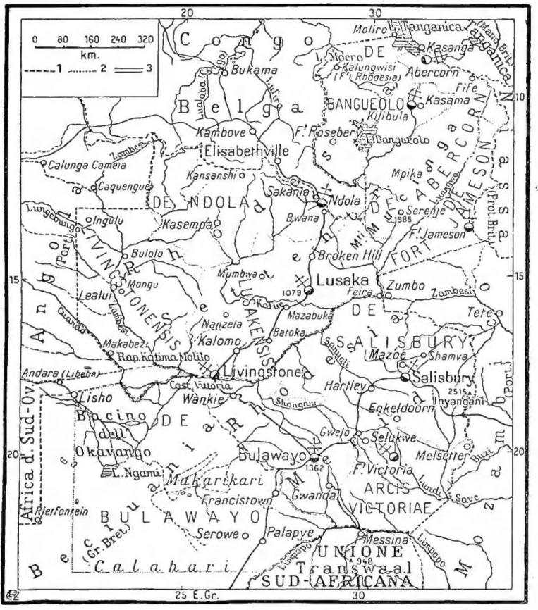
RODESIA - 1) State or colonial boundaries; 2) boundaries of ecclesiastical jurisdictions; 3) railways.
neries, chemical products, fertilizers, textiles, etc.), but their more rational expansion is conditioned by the solution of the two essential problems of R.: the influx of labor and the availability of adequate outlets for production.
The indigenous population consists of Bantu Negroes, mostly pagans. The Europeans number fewer than 150,000, of whom barely 22,000 are in Northern R. The inhabited centers are still sparse and small: only Salisbury and Bulawayo in Southern R. exceed 50,000 inhabitants.
Northern R. is a protectorate with a governor appointed by the Crown, who heads two councils, one legislative and one executive, partly elected; Southern R., which has been a colony since 1923 and enjoys greater autonomy, is moving toward the establishment of a Dominion to which, in addition to Northern R., other units of British central and southern Africa would eventually be incorporated.
| Colonies | Area sq. km. | Population (in thousands of inhabitants) | density per sq. km. | Capital and its population (in thousands of inhabitants) |
|---|---|---|---|---|
| Northern R. | 751,980 | 1,866 | 2 | Lusaka (3) |
| Southern R. | 389,347 | 2,095 | 5 | Salisbury (70) |
| The two R. | 1,141,327 | 3,961 | 3 | — |
II. HISTORY
Present-day Southern R., in the second half of the 19th century, that is, when that part of Africa began to interest Europeans, formed part of the indigenous kingdom of the Matabele and constituted an extremely important zone for further British expansion on the African continent. Its occupation by the Boers would in fact have shattered the British dream of joining the Cape Colony and the Bechuanaland Protectorate with the English territories of East Africa and would have isolated the British possessions at the southern extremity of the continent. Fearing that the Boers of the Transvaal might invade Matabeleland, Cecil Rhodes, through one of his emissaries, Moffat, concluded a treaty in 1888 with Lobengula, king of the Matabele, by virtue of which the indigenous sovereign undertook not to cede his territories to anyone else without British consent. Immediately the following year Rhodes obtained from the British government recognition of the British South Africa Company, of which he was one of the directors; its purpose was the exploitation and administration of Matabeleland and Mashonaland. Its sphere of activity was vaguely defined as the region north of the Cape Colony and west of the Portuguese dominions of East Africa, but as early as 1891 the Company extended its influence north of the Zambezi River, and thus into present-day Northern R. After the great Matabele revolt of 1896, white colonization developed in the two R., encouraged by mineral wealth and the fertility of the soil. When the concession of the British South Africa Company expired in 1915, it was, owing to the outbreak of the First World War, extended for a further ten years, until in 1923 and 1924 the two R. acquired colonial status. Subsequently Southern R. achieved considerable political autonomy, bringing its position closer to that of a Dominion of the Commonwealth, and in 1948 the prime minister, sir Godfrey Huggins, attended the Commonwealth prime ministers’ conference in London. Northern R., whose boundaries were precisely determined in 1911, likewise came under the direct authority of the Crown, represented by a governor-general assisted in his administrative action by an executive council. The discovery in 1931 of particularly rich copper deposits helped to encourage white immigration and brought to the forefront the need for appropriate measures for the indigenous population, both with regard to its participation in the government of the region and to favorable social legislation. At present, in the two R., their union with the territory of Nyasaland is being advocated. The Central African Council was therefore established in 1944, composed of the governors of the three territories, the prime minister of Southern R., and nine members (three for each territory). In February 1949, at a conference between representatives of the three territories, extensive discussion was devoted to the possibility of creating a federation on the Australian model.III. EVANGELIZATION
The first missionary in present-day southern R., that is, in the Kingdom of Monomotapa, was the Jesuit Gonçalo da Silveira in 1560; he succeeded in converting the reigning prince and several chiefs. On 15 March 1561 he fell victim to the intrigues of the Muslims at court. A punitive expedition undertaken by the Portuguese in 1571 failed. From 1577 the Dominicans of the convent of Mozambique also carried the mission into the Kingdom of Monomotapa. In 1607 the Jesuits joined them. In 1628 a war broke out between the Portuguese and Monomotapa, won by the former under the leadership of the Dominican Luiz do Espiritu Santo; but in 1633 the Portuguese and the Dominicans were again massacred. In 1652 the Dominicans once more succeeded in baptizing the reigning prince, but neither the Dominicans nor the Jesuits were able to establish Christianity permanently in the territory of Monomotapa, and in the 18th century the mission came to an end because of political complications and the suppression of the Society of Jesus.The recent missionary activity in R. began during the 19th century: in the south from 1879 through the work of the Jesuits, and in the east through the White Fathers from 1895. In fact, in 1879 the mission of the Zambezi was entrusted to the Jesuits; it included present-day southern and northern R., the northern part of Bechuanaland, and the territories along the Zambezi in Portuguese East Africa. After more than ten years of work and great sacrifices, they succeeded in establishing themselves in southern R. In 1893 the territory was occupied by the English, who also suppressed the uprisings of the Marblee and the Mashonas in 1896. The new situation enabled the apostolate to make greater progress. Later, the Trappists of Mariannhill joined them; they founded a missionary centre at Triashill, as did the Polish Jesuits, who established their stations in northern R., advancing from Brokenhill. In 1915 the Mission of the Zambezi was raised to an apostolic prefecture; in 1927 the northern part was detached as the apostolic prefecture of Brokenhill. In 1931 the prefecture of the Zambezi was raised to an apostolic vicariate under the name of Salisbury, and the western part was ceded to the Fathers of Mariannhill as the mission of Bulawayo. The Irish Capuchins joined the Polish Jesuits of Brokenhill in 1931, and the Italian Conventuals in 1938. In the southern part of Salisbury, the Swiss missionary society of Bethlehem entered the mission field in 1938.
From 1895 the White Fathers worked in northern R. among the Babemba tribe. Mons. Giuseppe Dupont achieved great success and was even elected chief of the indigenous people. With the help of well-trained catechists, he founded flourishing Christian communities. In 1913 Babembaland was detached from the vicariate of Niassa and erected into the apostolic vicariate of Bangweolo, which was again divided in 1933 and 1937.
(phot. Fides)
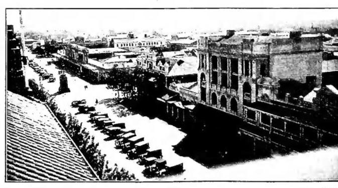
RODESIA – Government school in Lusaka.
apostolic vicariate entrusted to the Society of the Foreign Missions of Bethlehem (Switzerland); Salisbury, 1879 mission, under the name of Zambesi, 1915 apostolic prefecture, 1927 renamed Salisbury, 1931 apostolic vicariate entrusted to the Jesuits. Northern R.: Kasama, 1913 apostolic vicariate of Banguelo, in 1952 under the name of Kasama, entrusted to the White Fathers; Fort Rosebery, 1952 apostolic prefecture; Fort Jameson, 1937 apostolic prefecture entrusted to the Missionaries of Africa; Livingstone, 1936 apostolic prefecture under the name of Victoria Falls, 1950 apostolic vicariate entrusted to the Capuchins; Lusaka, 1927 apostolic prefecture under the name of Brokenhill, renamed Lusaka in 1946, 1950 apostolic vicariate entrusted to the Jesuits; Abercorn, 1913 Missio sui iuris of Lwangwa, 1937 apostolic vicariate entrusted to the Missionaries of Africa, renamed Abercorn in 1951; Ndola, 1938 apostolic prefecture, 1949 apostolic vicariate entrusted to the Conventual Friars Minor.