
UNIONE SUDAFRICANA. -
I. GEOGRAPHY
Dominion (since 1910) forming part of the British Commonwealth and consisting of a federation of four units (provinces), of very different territorial extent and demographic importance, as appears from the following table.| Provinces | Area in sq. km. | Population in thousands (1946 census) | Density per sq. km. | Capital (population in thousands) |
|---|---|---|---|---|
| Cape Province | 717,839 | 4045.8 | 6 | Cape Town (470) |
| Orange | 128,580 | 876.6 | 7 | Bloemfontein (83) |
| Transvaal | 286,053 | 4271.6 | 15 | Pretoria (242) |
| Natal | 91,382 | 2197.9 | 2 | Maritzburg (63) |
| 1,223,854 | 11391.9 | 9 |
The territory of the U. S. corresponds to the southern extremity of the African continent and is bounded to the N. by the courses of the Orange, Molopo, Tlapin, Marico, and Limpopo rivers and by the Lebombo highlands. It consists essentially of a plateau rising in steps from a narrow coastal strip, interrupted by rocky promontories, the most prominent of which, that of Table Mountain (Table Mt., 1082 m.), which dominates Cape Town, terminates at the Cape of Good Hope.
Along its southern margin, the plateau rises into the Drakensberg (M. of the Dragons), which locally (Orange) take on an alpine appearance (M. aux Sources, 3280 m.) and constitute the country’s most important watershed. The climate, as a result of the altitude (1000-1300 m. on the plateau), is mild and healthy, but the rains, abundant along the south-eastern fringe, decrease towards the W., and much more rapidly and decisively towards the interior. Thus one passes gradually from the coastal strip (subtropical in character, and cultivated with cotton, maize, sugar cane, rice, tea, and bananas in the E.; Mediterranean in type, with wheat and above all tree crops, in the S. and W.), to the steppes of the plateau, devoted predominantly to pastoral activity, with small agricultural oases, and forests corresponding to the high, humid mountains of the provinces
of the Transvaal and Orange, and finally to the semi-desert regions of the N., bordering the Kalahari (on the right bank of the middle and lower Orange River).
The province (formerly Colony) of the Cape was, until a short time ago, the most important region of southern Africa. Its climate permits agriculture similar to that of Italy, and extensive open-range sheep raising flourishes there. In the middle basin of the Orange lie the rich diamond fields centred on Kimberley, while, in addition to those of East London and Port Elisabeth, the province possesses the magnificent Port of Cape Town, the bridgehead of the trans-African railway and the country’s principal exporting emporium. The province (formerly Colony) of Natal is a mountainous region, but along the coast it is well suited to various tropical crops. The Transvaal and Orange, formerly independent Boer Republics and later British colonies, are both livestock-raising territories; but for more than a century the Transvaal has become the world’s most important producer of gold and, more recently, also an industrial country, given the great richness of its subsoil, which the last decades have increasingly brought to light.
In the Union as a whole, livestock raising is economically more significant than agriculture (cereals, first and foremost maize; fruit trees, vines, tea, sugar cane, etc.) (32 million head of cattle, 6 million goats, 12 million sheep); it provides meat (including frozen meat), hides, and dairy products, and above all wool, of which the U. S. is today one of the world’s major suppliers. But the Union finds the foundations of its prosperity in the immense mineral resources at its disposal: gold and diamonds (first place in the world), coal (the largest deposits on the continent), iron, manganese, chromite, tin, copper, asbestos, etc.
This variety and wealth of raw materials have enabled the development of a flourishing industry, which the two recent world wars have powerfully stimulated and whose only limitations so far have been the low purchasing capacity of the domestic market and the great distances that, by contrast, separate the Union from the world’s principal consumer markets.
The population (12.4 million inhabitants in 1950) consists of 3/4 Bantu blacks, 1/5 whites (1.3 million of English origin; 1 million Boers, descendants of the Dutch colonists who settled there towards the end of the seventeenth century), and the remainder people of mixed blood (coloured) and Asians (mostly Indians). The number of urban centres is notable, half a dozen of which exceed 100,000 inhabitants (besides those mentioned above, Port Elisabeth, Springfontain, and Germiston). The seat of Parliament is in Cape Town (Cap town), that of the government in Pretoria; but the centre of economic life is Johannesburg (760,000 inhabitants), in the Trasvaal. Durban (340,000 inhabitants), in Natal, is one of the busiest ports.
In the Dominion, executive power belongs to the Governor-General; legislative power to an elected bicameral Parliament. In addition to English, Afrikaner is considered an official language.
II. HISTORY
No information is available concerning the history of the indigenous populations and the lands of present-day U. S. before the discovery of the Cape of Good Hope, although the habitability of those regions, even in prehistoric times, is confirmed by the discovery, in past decades, of human skulls and bones.The Europeans learned of the Cape of Good Hope after the voyage of the Portuguese Bartolomeo Diaz, who, while attempting to reach India, had the good fortune to discover it on the return journey in the first months of 1488. The Cape was then rounded in 1497 by Vasco da Gama, who on Christmas Day of that same year sighted Natal, so named by him in remembrance of the Christmas feast. The Portuguese, however, never settled in southern Africa and indeed avoided landing in the Cape region because of the hostility of the Hottentots, who in 1510 had killed Francisco de Almeida, the first viceroy of Portuguese India, after he had gone ashore in Table Bay. When the Portuguese ruling house became extinct and that kingdom was united with the Spanish crown, Philip II, engaged in conflict with the rebellious Netherlands, forbade Dutch ships to call at Lisbon during their voyages to India. This measure, adopted with the intention of striking at the commercial and maritime activity of the United Provinces, led in 1652 to the occupation, by the Dutch East India Company, of the Cape of Good Hope, where a provisioning station was established for ships bound for the Sunda Islands. Although the Company was opposed to the immigration of Europeans and to any extension of the territorial occupation, the Cape’s very character as a provisioning port subsequently encouraged the arrival of colonists (Dutch, Germans, and French Huguenots), who promoted the cultivation of agricultural products and the raising of livestock.
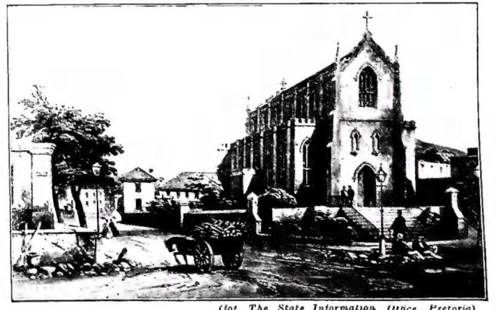
The Boers (the name given to the Dutch-speaking colonists) therefore decided to seek a new homeland where they could live independently and according to their own laws. This was the reason for the so-called Great Trek, the emigration of approximately ten thousand people from the Cape Colony between 1836 and 1846. They proceeded eastward, into Natal, and toward the
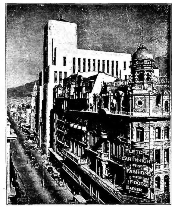
(photograph: The State Information Office, Pretoria) UNIONE SUDAFRICANA - Darling Street in Capetown (Cape Town).
The first Premier of the Union was General Botha. At the outbreak of the First World War, the U. S., despite strong opposition from part of the Boers, declared war on Germany, and its armed forces proceeded to occupy German South-West Africa and took part in operations in German East Africa. After Botha’s death in 1919, he was succeeded as prime minister by General Smuts, who was strongly favorable to England. Opposed by the nationalists, he had to relinquish power following the elections of 1924, in which his South African Party failed to obtain a majority, to General Hertzog, who instead pursued a policy aimed at fully asserting the equal rights of the Afrikaners (South Africans of Afrikaans, that is, Cape Dutch, language).
Having formed a coalition with Smuts’s party in 1933, Hertzog continued to head the government until 4 September 1939, when his proposal to maintain the Union’s neutrality in the Second World War failed to win Parliament’s approval. The new cabinet headed by Smuts declared war on the Axis powers and firmly supported the war effort of the British Empire. In the elections of 6 May 1948, the majority of the electorate gave its votes to the nationalist coalition of D. F. Malan, whose government is characterized by a clear racist stance in favor of the Europeans of the U. S., with the aim both of safeguarding the purity of the white race and of preventing the colored populations from acquiring any effective political weight.
BBL.: S. Mendelssohn, South African bibliogr., London 1910; H. Conover, The Union of South Africa, A selected list of references, Washington 1943; M. S. Geen, The making of the Union of South Africa, London 1946; M. Roberts-A. E. G. Trollip, The South African Opposition 1939-45, ibid. 1947; H. J. May, The South African Constitution, 3rd ed., Cape Town 1949; O. Hintrager, Geschichte von Südafrika, Munich 1952; L. Marquard, The peoples and policies of South Africa, London 1952; E. P. Dvorin, Racial separation in South Africa, An analysis of Apartheid theory, Chicago 1952. Silvio Furlani
III. EVANGELIZATION
Under the rule of the Calvinist Boers, who settled at the Cape of Good Hope in the 17th and 18th centuries, all Catholic ministry and any Catholic missionary activity were impossible. The decree of toleration of 1804 permitted the entry of the first Catholic priests, who, however, were expelled by the English in 1806. From 1820 Irish priests succeeded in building a small church in Cape Town, which formed part of the apostolic vicariate of the Cape of Good Hope, Mauritius, Madagascar, and Australia, erected in 1818–1819. But only with the erection of a separate apostolic vicariate, called that of the Cape of Good Hope, in 1837, and under its first bishop, Raimondo Griffith, O. P., was it possible to organize the pastoral ministry. In 1847 the apostolic vicariate of the Cape of Good Hope was divided into the apostolic vicariates of the Cape of Good Hope, western district, and of the Cape of Good Hope, eastern district. In 1850 the apostolic vicariate of Natal was erected. Here the Oblates of Mary Immaculate began their mission among the black population, first among the Zulu and then, owing to the difficulties encountered, among the Basuto of Basutoland. In the Orange Free State the first Catholic priest, the Premonstratensian Hoenderwanger, was able to settle in Bloemfontein. His successors, the Oblates of Mary Immaculate, extended their activity to the Transvaal. Here their first task was ministry among the numerous emigrants drawn to southern Africa by the discovery of diamonds at Kimberley and by the gold mines at Witwatersrand. In 1886 two new ecclesiastical districts were erected: the apostolic vicariate of the Orange Free State, also including Griqualand and Basutoland, and the apostolic prefecture of the Transvaal, both entrusted to the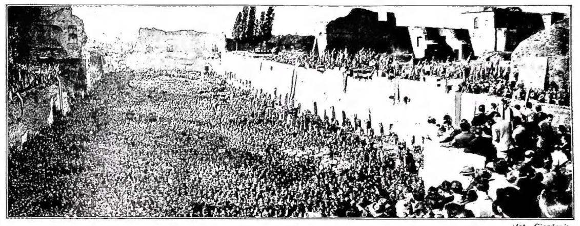
UNIONE UOMINI DI AZIONE CATTOLICA - Men of Catholic Action gathered in the Stadium of Domitian, on the Palatine, while Prof. Gedda speaks, during the celebrations for the Thirtieth Anniversary (12 Oct. 1952) - Rome.
Oblates. Meanwhile, the Missionary Seminary of Lyons had begun its mission among the blacks of the north of the Cape Colony, in the apostolic prefecture of the Cape of Good Hope, central district, erected in 1874; it was succeeded in 1882 by the Oblates of St. Francis de Sales, and in 1885 the territory was separated from the aforesaid prefecture as the apostolic prefecture of the Orange River. More intensive activity among the blacks was carried on by the Trappists, who arrived in 1880 in the eastern district of the Cape of Good Hope and in 1882 in Natal, and from their abbey of Mariannhill founded flourishing mission stations. In 1910, the year of the foundation of the U. S., comprising the Cape Colony, Natal, and the Boer States subjected to the English after the Boer War of 1899-1902, the Orange Free State and Transvaal, there existed in the territory of the U. the apostolic vicariates of the Cape of Good Hope (western district), the Cape of Good Hope (eastern district), Natal, Kimberley, Transvaal, Orange River, and the apostolic prefecture of the Cape of Good Hope (central district). In Transvaal the Benedictines of the Cassinese Congregation assumed charge of the apostolic prefecture of northern Transvaal, erected in that same year, 1910.
After the First World War German missionaries too went in greater numbers to southern Africa: the Benedictines of St. Ottilia to Zululand in 1921; the Pallottines to the Cape of Good Hope (central district) in 1922, and to Queenstown in 1929; the Missionaries of the Holy Spirit to Kroonstad, Orange Free State; the Priests of the Sacred Heart to Gariep, Eastern Cape; the Missionary Sons of the Sacred Heart to Lydenburg, eastern Transvaal, in 1923.
In 1921 Mariannhill had become a separate apostolic vicariate, divided in 1930 into Mariannhill and Umtata; in 1935 the apostolic prefecture of Mount Currie, entrusted to the Franciscans of the Bavarian province, was detached from Mariannhill. With these erections, missionary work, hitherto for the most part restricted to European Catholics, was extended to the indigenous population. Important progress was recorded, though hindered by conflicts and struggles among the races. In 1922 the apostolic delegation was established.
In the years after the Second World War there were further divisions, with the erection of the apostolic vicariates of Bethlehem and Pretoria in 1948. On 11 Jan. 1951, in the U. S., including Basutoland and Swaziland, the ecclesiastical hierarchy was erected, with 4 archdioceses and 17 dioceses: archdiocese of CAPETOWN, erected as an apostolic vicariate in 1818, in 1837 it received the name of Cape of Good Hope, and from 1847 that of Cape of Good Hope, eastern district, entrusted to the secular clergy. Diocese of ALIWAL, erected as the apostolic prefecture of Gariep in 1932, apostolic vicariate of Aliwal in 1936, entrusted to the Priests of the Sacred Heart. Diocese of QUEENSTOWN, erected as a mission in 1929, apostolic prefecture in 1938, apostolic vicariate in 1948, entrusted to the Pallottines. Diocese of OUDTSHOORN,
erected as the apostolic prefecture of the Cape of Good Hope, central district, in 1874, apostolic vicariate of Oudtshoorn in 1948, entrusted to the Pallottines. Diocese of PORT ELIZABETH, erected as the apostolic vicariate of the Cape of Good Hope, eastern district, in 1847, it received the name of Port Elizabeth in 1939; entrusted to the secular clergy. Archdiocese of DURBAN, erected as the apostolic vicariate of Natal in 1850, entrusted to the Oblates of Mary Immaculate. Diocese of MARIANNHILL, erected as an apostolic vicariate in 1921, entrusted to the Congregation of Mariannhill. Diocese of ESHOVE, erected as the apostolic prefecture of Zululand in 1922, apostolic vicariate of Eshove in 1923, entrusted to the Benedictines of St. Ottilia. Diocese of KOKSTAD, erected as the apostolic prefecture of Mount Currie in 1936, apostolic vicariate of Kokstad in 1939, entrusted to the Franciscans. Diocese of UMTATA, erected as an apostolic prefecture in 1930, apostolic vicariate in 1937, entrusted to the Congregation of Mariannhill. Archdiocese of PRETORIA, erected as an apostolic vicariate in 1948, entrusted to the secular clergy. Diocese of JOHANNESBURG, erected as the apostolic prefecture of Transvaal in 1886, apostolic vicariate in 1904, it received its present name in 1948, entrusted to the Oblates of Mary Immaculate. Diocese of LYDENBURG, apostolic prefecture in 1923, apostolic vicariate in 1948, entrusted to the Missionary Sons of the Sacred Heart. Diocese of BREMERSDORF, erected as the apostolic prefecture of Swaziland in 1923, apostolic vicariate in 1939, entrusted to the Servites. Abbey « nullius » of PIETERSBURG, erected as the apostolic prefecture of northern Transvaal in 1910, abbey « nullius » of Pietersburg in 1939, entrusted to the Benedictines. Archdiocese of BLOEMFONTEIN, erected in 1951, entrusted to the Oblates of Mary Immaculate. Diocese of BETHLEHEM, erected as an apostolic vicariate in 1948, entrusted to the Congregation of the Holy Spirit. Diocese of KEIMOSS, erected as the apostolic prefecture of the Orange River in 1885, apostolic vicariate in 1898, it received its present name in 1940, entrusted to the Oblates of St. Francis de Sales. Diocese of KIMBERLEY, erected as the apostolic vicariate of the Orange Free State in 1886, it received its present name in 1918, entrusted to the Oblates of Mary Immaculate. Diocese of KROONSTADT, erected as an apostolic prefecture in 1923, apostolic vicariate in 1935, entrusted to the Dominicans. Diocese of MASERU, erected as the apostolic prefecture of Basutoland in 1894, apostolic vicariate in 1909, entrusted to the Oblates of Mary Immaculate. Diocese of LERIBE, erected in 1952, entrusted to the national clergy. - See pl. LXXXI.